European Union flag
EU Space Policy

Explore EU Space

Results (1952)
Images
First snowfall of the season over the Pyrenees
Earth Observation | Copernicus
The Pyrenees are an important ecological corridor stretching between France and Spain, connecting Atlantic and Mediterranean ecosystems across a rugged mountain landscape. The mountain range supports…
Images
October 2025, the third warmest October on record
Earth Observation | Copernicus
The Copernicus Climate Change Service (C3S) has published its latest monthly Climate Bulletin, which focuses on key climate trends in October 2025. The bulletin reports that October 2025 was the…
Images
Belém hosts COP30
Earth Observation | Copernicus
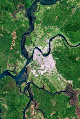
Belém, the capital of the state of Pará in northern Brazil, lies near the mouth of the Amazon River and has grown into a key economic and logistical centre for the wider Amazon region. Located within…
Images
The Tatra Mountains, Poland and Slovakia
Earth Observation | Copernicus
The Tatra Mountains, visible in this Copernicus Sentinel-2 image, acquired on 20 October 2025, form a natural border between southern Poland and northern Slovakia, are among Central Europe’s most…
Images
Dust over the Arabian Sea
Earth Observation | Copernicus
A large plume of dust swept across the Arabian Sea in early November 2025, driven by strong north-westerly winds transporting fine particles from the arid regions of Iran and southern Pakistan.  Dust…
Images
Devastating flooding in Vietnam
Earth Observation | Copernicus
In late October 2025, severe flooding struck Vietnam after days of intense rainfall. Thousands of residents evacuated their homes, with local authorities reporting at least 37 casualties. The…
Images
Coastal ecosystems in northern Egypt
Earth Observation | Copernicus
At the northeastern edge of Egypt’s Nile Delta, the Damietta branch of the Nile flows towards the Mediterranean Sea, crossing a region of significant ecological and economic importance. This area…
Images
Copernicus Sentinel-1D: a new EU satellite in orbit
Earth Observation | Copernicus
Copernicus Sentinel-1D was successfully launched on 4 November 2025 at 22:02 CET (21:02 UTC) aboard an Ariane 6 rocket from the European Spaceport in Kourou, French Guiana. The satellite was released…
Resources
Earth Observation | Copernicus
The toolkit provides a methodological framework for monitoring elements, processes and services associated to fluvial landscapes (e.g., riparian forest composition, riparian habitat connectivity, water quality) using CLMS products and complementary approaches to support decision-making in biodiversity and water resource management, restoration, and
Resources
Earth Observation | Copernicus
Throughout the Cop.RIVER project, a series of national and EU-level activities were carried out engage relevant stakeholders, promote the use of Copernicus data, and develop tailored products for monitoring fluvial landscapes.
Resources
Earth Observation | Copernicus
The Cop.RIVER User Uptake Session was held in mid-September 2025. The session aimed to present an overview of CLMS products contributing to the characterisation of elements and phenomena associated with riparian vegetation, river hydromorphology and the aquatic component of the fluvial landscape.
Resources
Earth Observation | Copernicus
The expert workshop “Needs and Methodologies for the Characterisation of Water and Sediments in Fluvial Ecosystems”, held on September 23, 2026, brought together more than 30 participants from public organizations.
Resources
Earth Observation | Copernicus
Between June and September 2025, Cop.RIVER team members attended several meetings with the General Directorate of Forests and Biodiversity and the Cantabrian Hydrographic Confederation to develop a LIFE proposal related to the invasive species Reynoutria japonica.
Images
Ash emissions from the Planchón-Peteroa volcano
Earth Observation | Copernicus
On 25 October 2025, the Planchón-Peteroa volcanic complex, located on the Chile–Argentina border, emitted a sustained plume of volcanic gas and fine ash that rose to approximately 600 m above the…
Images
Inland Delta of the Niger River, Mali
Earth Observation | Copernicus
The Inland Delta of the Niger River, classified as a Ramsar wetland of international importance in 2004, supports agriculture and biodiversity in Mali.  At the northern edge of the delta in Mali,…
Images
The southern tip of South America as seen from space
Earth Observation | Copernicus
This image, acquired by one of the Copernicus Sentinel-3 satellites on 27 October 2025, provides a rare, cloudless view of the southernmost regions of South America, including parts of Argentina and…
Images
Mapping Dublin’s Urban Fabric on World Cities Day
Earth Observation | Copernicus
On World Cities Day, 31 October 2025, we spotlight Dublin, Ireland’s capital and a hub of cultural, economic, and social activity. Rapid urban expansion in some European cities such as Dublin brings…

Showing 341-360 of 1952 results