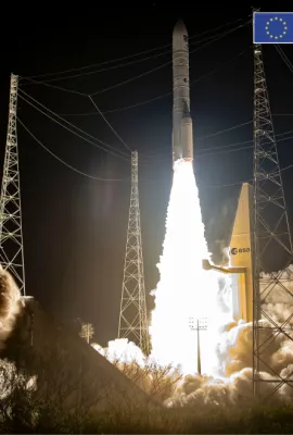
DWD’s website has been updated to include sub-seasonal climate predictions for Germany.
Results (1987)
ISPRA | Veneto | Italian
The fifth edition of the German newsletter on climate predictions and climate projections has been published in October 2022.
CBK PAN | Zamość, Poland | Polish
CBK PAN | Biała Podlaska | Polish
ISPRA | Florence | Italian
Explore how Copernicus data can enhance monitoring and maintenance for energy suppliers and infrastructure managers in France’s Grand Est region. This initiative will create tailored solutions that optimize monitoring and maintenance activities, driving innovation and economic growth.
The action aims at sharing knowledge and experience among European, and especially among French, German, and Swiss regions and at promoting the operational uses of Copernicus data and services by Local and Regional Authorities.
The aim of this action is to settle a meaningful, concerted and scalable effort to build Copernicus related capacities among African Copernicus expert communities and actor networks to enable knowledge growth.
U-CLIMADAPT is a joint action by the FPCUP internal Working Group “Impact of Climate Change” with partners from Deutscher Wetterdienst (DWD), ETH Zurich / MeteoSwiss, CNRS, IHCantabria / Universidad de Cantabria.
The objective of the action is to promote the use of Copernicus data for monitoring of coastal and inland waters. The proposal will focus on advancing the use of high- and medium-resolution multisensor data.
This joint action aims to coordinate a group of sub-actions in different topics to promote the user uptake of Copernicus data and services in Central & South America.
This action addresses the development of a Copernicus Climate Change Service (C3S) App on the Climate Data Store (CDS) for a Europe-wide provision of snow load climatological information for civil engineering as well as hazard and damage prevention purposes.
The aim of this action is to couple advanced hydrodynamics with advanced marine observation systems in order to optimize the O&M logistics of floating offshore wind farms.
The overall goal of this action is to promote the use of Copernicus data in the implementation of the EU Marine Spatial Planning Directive and EU Marine Strategy Framework Directive.
This action targets the use of Copernicus data for a sustainable development of the maritime sector, focusing on Ports and Harbours, Aquaculture and Fisheries. The action will organise awareness and training events in Europe, Africa and South America.
The goal of Cop.RIVER is to create the basis for the characterization of riparian zones on a regional to European level based on reproducible Copernicus data and methods.
The aim of this action is to increase the use of Copernicus data and services in Portuguese Higher Education with awareness events and training sessions for students.
The Great Disaster Challenge is an educational activity using Copernicus earth observation data for disaster management. It is created by a consortium spanning eleven European countries, and will be carried out simultaneously in the participating countries.
The main goal of the action is to look for new possibilities of acquiring information about the Earth's surface in relation to landscape and spatial planning by using Copernicus data and services.
Showing 1561-1580 of 1987 results