Jotunheimen mountain range, Norway
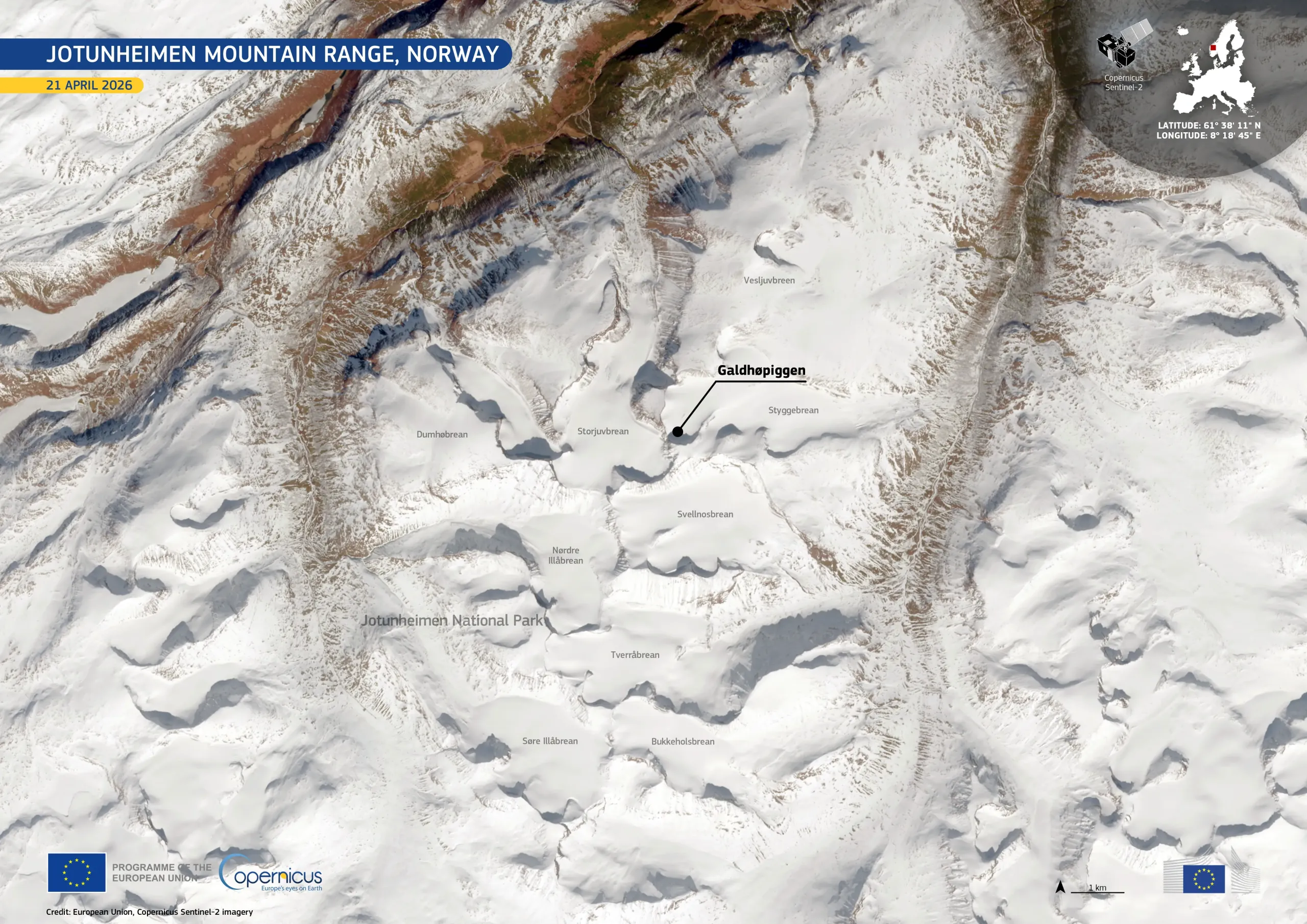
The Jotunheimen mountain range in southern Norway is home to the country’s highest peaks, including Galdhøpiggen, the highest peak in both Norway and Northern Europe. Within the range lies the Jotunheimen National Park, a protected area known for its glaciers and alpine landscapes.
This image, acquired by one of the Copernicus Sentinel-2 satellites on 21 April 2026, shows part of the Jotunheimen National Park under extensive snow cover. Several of the range’s glaciers, including Styggebrean, Storjuvbrean, and Vesljuvbreen, are visible surrounding Galdhøpiggen.
Copernicus Sentinel-2 data support consistent monitoring of snow extent and glacier dynamics, contributing to climate studies, water resource management, and hazard assessment in high-mountain environments.

![Download [WEBP, 1003.65 KB]](https://eu-space.europa.eu/sites/default/files/2026-04/20260502_Galdh%C3%B8piggen.webp)