Tropical Cyclone Narelle, Australia
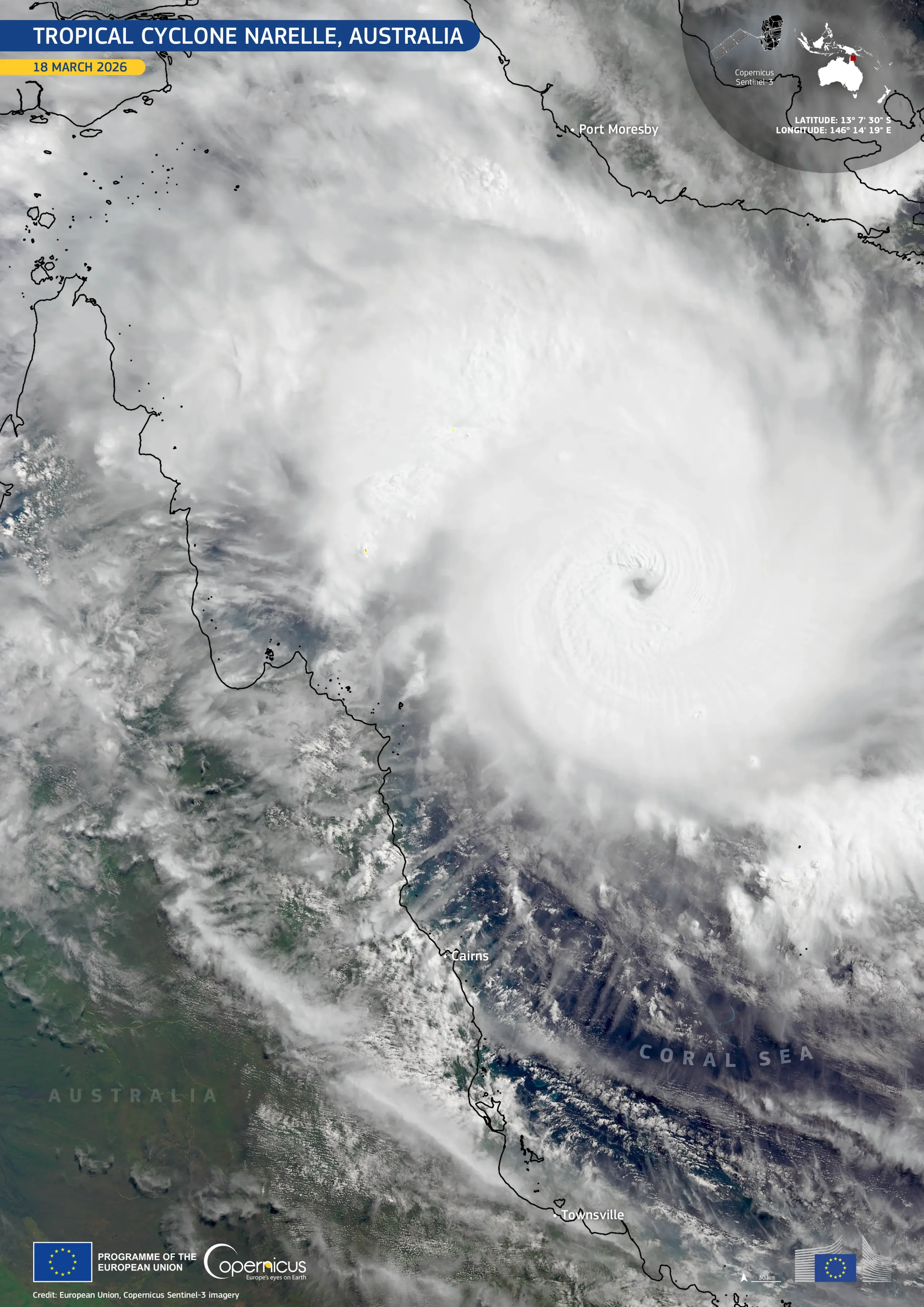
Tropical Cyclone Narelle formed on 16 March 2026 in the Coral Sea, off the coast of Queensland, Australia. In the following days, it rapidly intensified while moving towards Australia’s north-east coast, reaching Category 5, the most intense tropical cyclone classification, on 19 March 2026. It was the first cyclone of this category to affect the Cape York Peninsula in northern Queensland since 1899.
This image, acquired by one of the Copernicus Sentinel-3 satellites on 18 March 2026 at 12:11 UTC, shows Narelle as it approached the coast of Australia.
Copernicus Sentinel data is key for assessing the environmental impacts of tropical storms and other extreme weather events worldwide, improving understanding of these phenomena, and helping authorities prepare for and mitigate their impacts.

![Download [WEBP, 870.08 KB]](https://eu-space.europa.eu/sites/default/files/2026-03/20260320_Narelle%20Cyclone.webp)