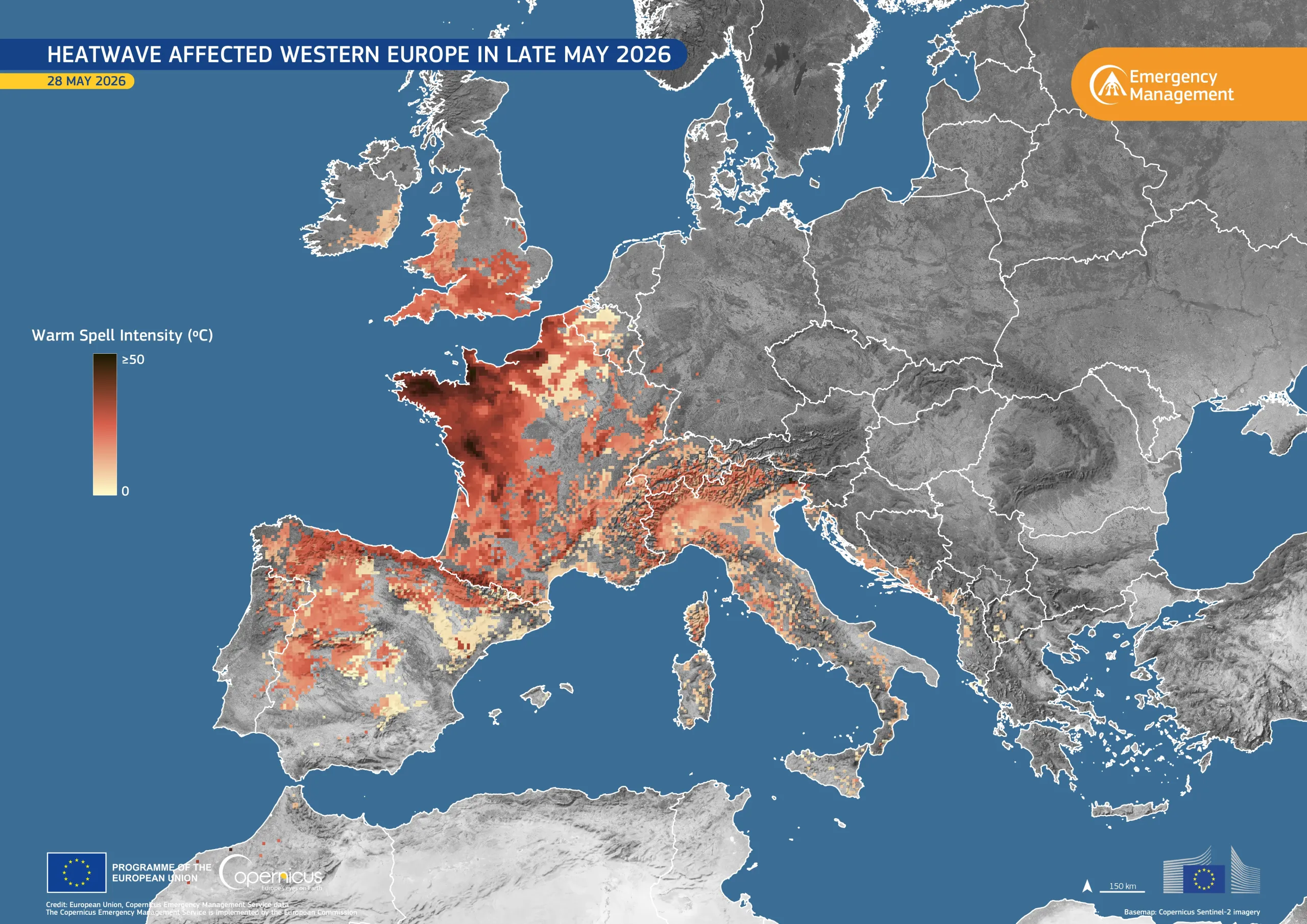
Heatwave affected Western Europe in late May 2026
World Day to Combat Desertification and Drought, observed on 17 June, highlights the importance of monitoring heat- and water-related stress on land, ecosystems, and societies.
Between 16 May and 2 June 2026, a heatwave affected large parts of Europe. Such prolonged warm spells can exacerbate drought conditions by increasing evaporation, reducing soil moisture, and affecting vegetation health.
This data visualisation shows the heatwave over western Europe on 28 May 2026 through the warm spell intensity index, an indicator provided by the European Drought Observatory of the Copernicus Emergency Management Service. This index identifies a heatwave as a period of at least three consecutive days with unusually high temperatures, capturing heat stress on people, land, and ecosystems more completely than air or surface temperature alone.
The highest values, shown in dark red, are visible over parts of France, northern Spain, Belgium, southern England, eastern Ireland, and northern Italy, indicating areas where temperatures were significantly above reference conditions.
Copernicus data support drought monitoring, risk assessment, and early warning activities by providing harmonised drought information, analytical tools, and reports on drought conditions across Europe and beyond.
More information on the last Report Drought in Europe May 2026 produced by the Joint Research Centre (JRC) here.

![Download [WEBP, 1.46 MB]](https://eu-space.europa.eu/sites/default/files/2026-06/20260617_Warm%20Spell%20Europe.webp)