Wildfire breaks out near Sisimiut, Greenland
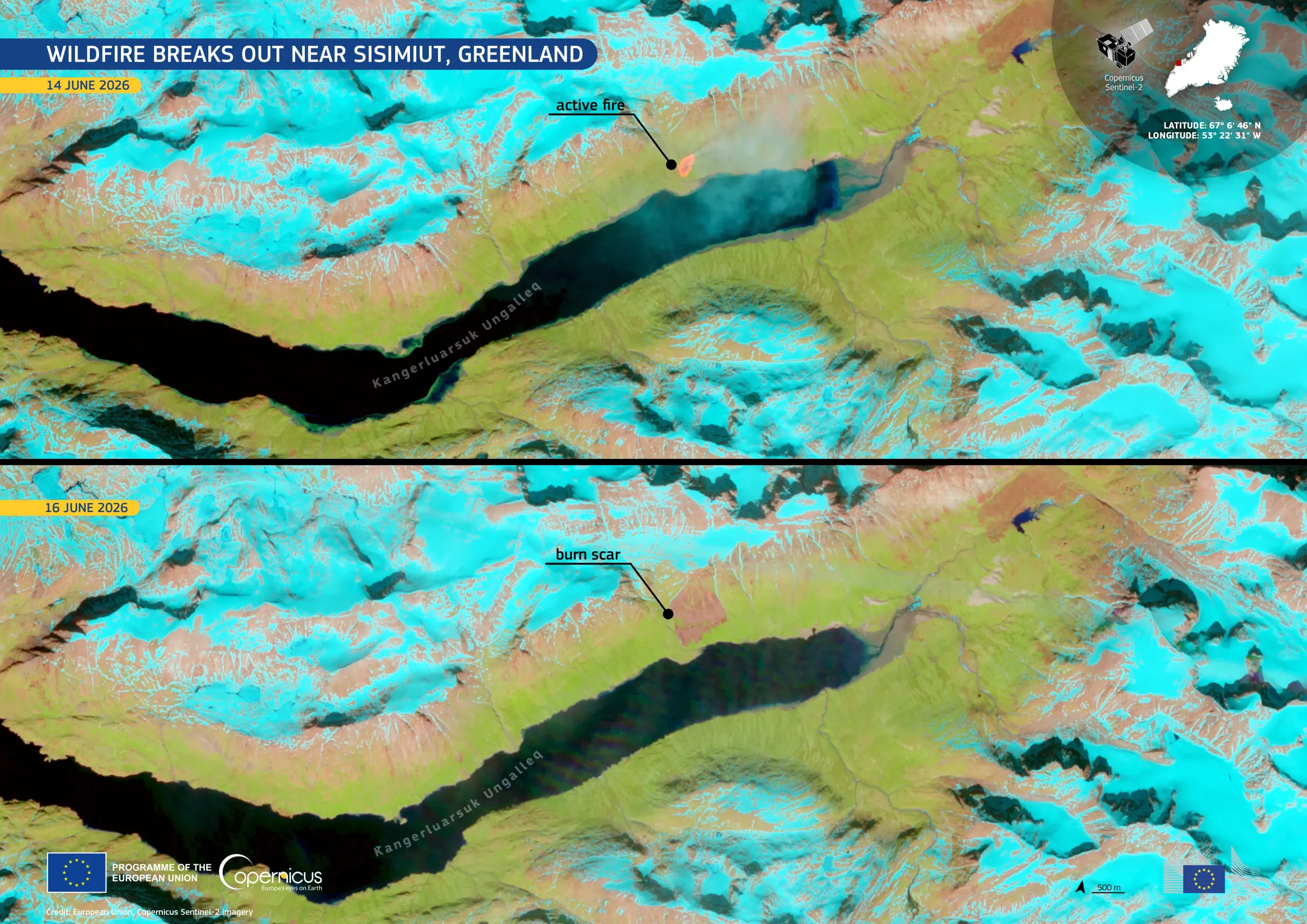
On 14 June 2026, a wildfire was reported close to the Kangerluarsuk Ungalleq fjord, north-east of Sisimiut, Greenland’s second-largest city. The fire broke out in a largely ice-covered landscape of rocky terrain and sparse vegetation. The Copernicus Emergency Management Service (CEMS) On-Demand Mapping module has been activated (EMSR883) to provide emergency mapping for wildfire extent and damage assessment.
Acquired on 14 and 16 June 2026 by Copernicus Sentinel-2 satellites, these false-colour images show the evolution of the fire. In the upper image, acquired on 14 June, the active fire is visible north of the fjord. The lower image, acquired on 16 June, shows the burn scar left by the fire. Snow and ice appear in cyan tones, while vegetation and bare ground are visible in green and brown shades, respectively.
Open data provided by the Copernicus Sentinel satellites and the Copernicus Emergency Management Service support the monitoring and mapping of wildfire extents and impacts worldwide.
![Download [WEBP, 1.04 MB]](https://eu-space.europa.eu/sites/default/files/2026-06/20260618_Greenland%20fire.webp)