Decoding Madrid’s urban landscape with Copernicus data
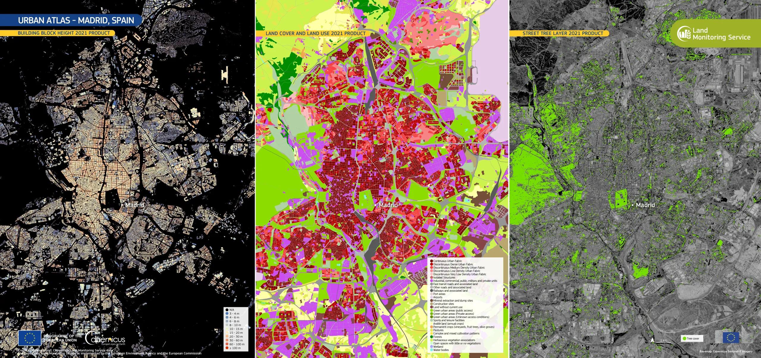
This data visualisation shows Madrid, Spain, as characterised by Copernicus Urban Atlas data. The left image shows the Building Block Height Layer, the central image shows the Land Cover/Land Use Layer, and the right image shows the Street Tree Layer. Together, these three images show Madrid’s dense urban core, transition of lower-density development towards the outskirts, as well as the distribution of green spaces and street trees across the city.
The June 2026 release of the Copernicus Land Monitoring Service (CLMS) Urban Atlas Product Suite is part of a new generation of land cover and land use information for urban areas across Europe. The suite comprises multiple thematic layers and innovative characterisation of urban green areas.
CLMS supports sustainable urban planning by providing high-resolution land use data. This supports local authorities in monitoring urban sprawl, planning resilient infrastructure, and managing natural areas.
More information is available here.
![Download [WEBP, 4.37 MB]](https://eu-space.europa.eu/sites/default/files/2026-06/20260610_Madrid%20Urban%20Atlas.webp)