Record-low water levels at Lake Velence, Hungary
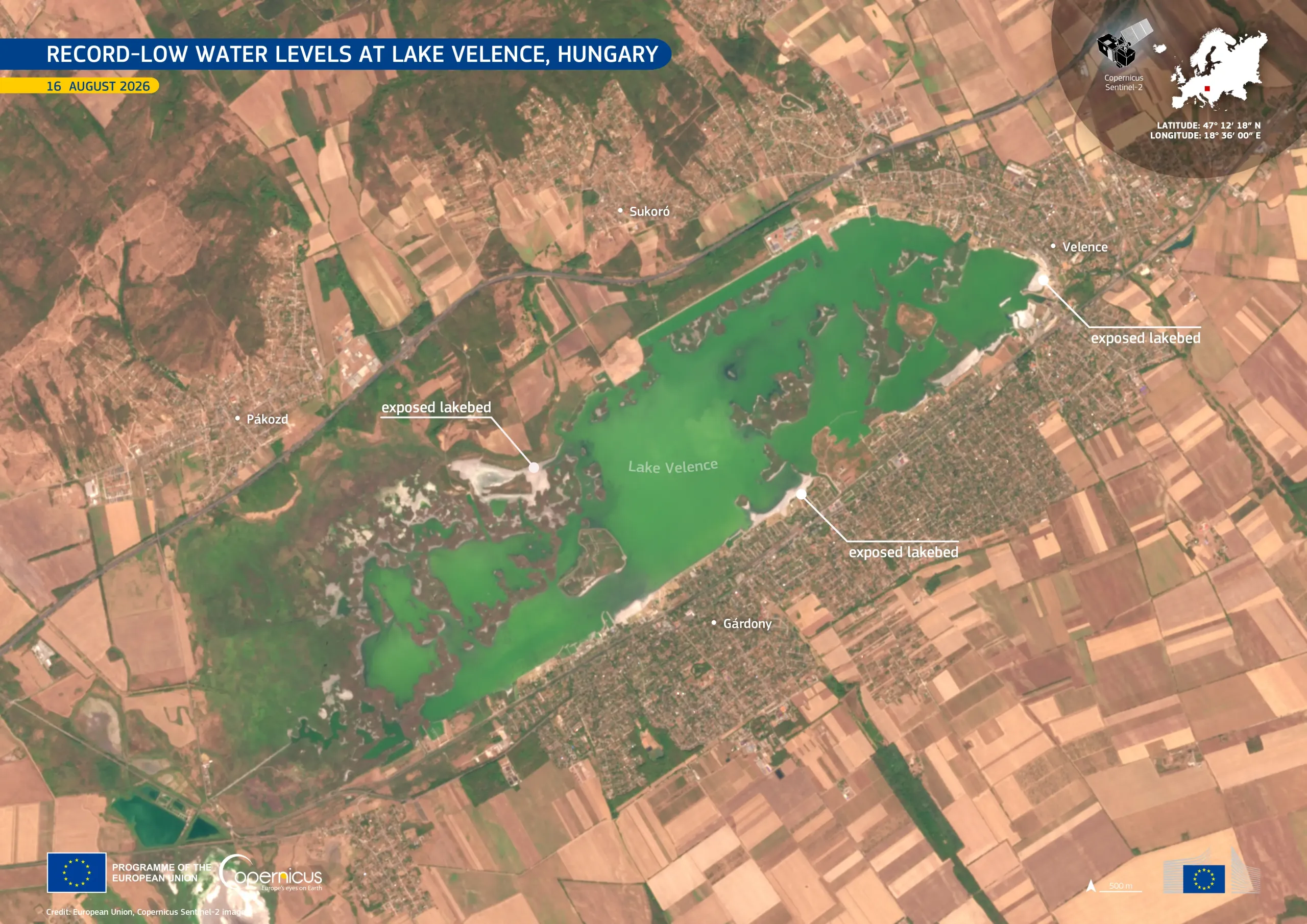
Lake Velence, Hungary’s third-largest lake, located southwest of Budapest, is affected by record-low water levels following prolonged dry conditions. By 1 August 2026, its water level fell below the previous historic minimum, and on 16 August the Agárd gauge recorded values of around 20 cm. The previous minimum of 53 cm was recorded during the severe drought of 2022.
This image, acquired by one of the Copernicus Sentinel-2 satellites on 16 August 2026, shows Lake Velence during this period of exceptionally low water levels. Areas of exposed lakebed are visible along parts of the lake’s shallow shoreline.
Copernicus Sentinel satellite data provide information useful for monitoring changes in inland water bodies and support drought assessment and water resource management.