The online user workshop on extreme snow loads across Europe under climate change was a great success.
Results (2161)
News

When Myanmar was hit by a strong earthquake, DG ECHO’s European Emergency Response Coordination Centre (ERCC) turned to the Copernicus Emergency Management Service (CEMS) for the rapid mapping and situational awareness to deliver support where it was needed most. In this Observer, we take a close look at how CEMS Rapid Mapping supported relief...
Image of the Day
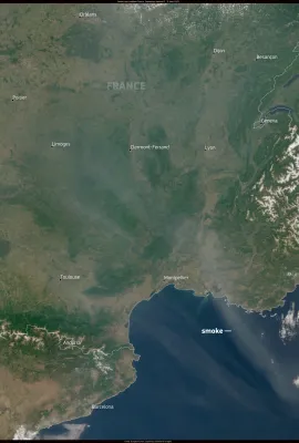
On 9 June 2025, a thin veil of smoke was observed drifting over several regions of France, including Normandy, Brittany, Occitanie, Auvergne–Rhône-Alpes, and Provence-Alpes-Côte d’Azur. The smoke, originating from the intense wildfires burning in Canada, was carried across the Atlantic and is visible in this Copernicus Sentinel-3 image acquired...
Image of the Day
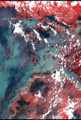
From late May to early June 2025, Sylhet and surrounding districts in northeastern Bangladesh were affected by extreme rainfall. Approximately 405 mm of rain fell within 24 hours on 1 June, making it one of the heaviest downpours of the season. This Copernicus Sentinel-2 image, acquired on 9 June 2025, shows extensive flooding across the...
Image of the Day
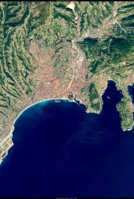
Nice, located on the southeastern coast of France along the French Riviera, is known for its stunning Mediterranean setting and rich cultural heritage. Situated between the Alps and the sea, Nice enjoys a mild climate year-round and is the leading resort city of the Côte d’Azur, or French Riviera. The city boasts a unique blend of French and...
Showing 466-470 of 2161 results