TIDAL ENERGY ASSESSMENT - TIDEA To date, there is no global solution providing a first level of information for ocean renewable energy site assessments for tidal energy devices (tidal current speed,…
Results (1952)
MONITORING HARMFUL ALGAL BLOOM IN THE BALTIC SEA: HAB-RISK SERVICE In the past recent years, severe blooms of cyanobacteria occured in the Baltic Sea during the summer season, forcing local…
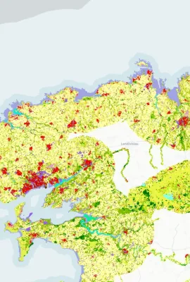
Urban Atlas Green infrastructure will play a key role in achieving EU policy objectives in a variety of interconnected environmental areas, especially when using nature based solutions to preserve…
SPOT – User-friendly oil spill model To minimize the terrible impact generated by oil spills in the oceans, it is important to intercept and collect them in time before they spread and reach the…
WATER QUALITY MONITORING TOOL SkyFISH service informs users of the availability of the fish resources and the sustainability of these resources in the Black Sea. This service is targeting the…
FOREST TREE CARBON MAPPING Since Iberian Mediterranean ecosystems are very sensitive to climate change effects, they require adaptive management for assessment, monitoring and management of organic…
CMEMS IN SUPPORT OF COPERNICUS MARITIME SURVEILLANCE SERVICE The European Maritime Safety Agency (EMSA) is the Entrusted Entity responsible for delivering the Copernicus Maritime Surveillance service…
A SYSTEM FOR PREDICTING GLOBAL AND REGIONAL TIDAL CURRENTS NOVELTIS is a private French service company specialized in space, environment, sustainable development and technological innovations. The…
The ozone layer protects us from potentially harmful ultraviolet (UV) radiation. CAMS monitors stratospheric ozone and provides UV forecasts based on this information. Ozone is a colourless and very…
AGROSAT In Italy, the application of precision farming is very heterogeneous and covers only 1% of the whole agricultural area. Meanwhile the agricultural system is required to maximise the…
JELLYX: A MONITORING TOOL TO DETECT JELLYFISH SWARMS Pollution, climate change, and marine habitats degradation are affecting ocean-based industries worldwide. Increasing events of jellyfish…
DROUGHT MONITORING IN ROMANIA In Romania, the complex agricultural drought is a climatic hazard phenomenon inducing the worst consequences in agriculture. The area subjected to desertification,…
Farm Sustainability Tool (FaST) - Space Data for Sustainable Farming The Farm Sustainability Tool (FaST) digital services platform is supported by the European Commission’s DG Agriculture and Rural…
CROP MONITORING IN EUROPE The European Commission’s Joint Research Centre (JRC) acquires and shares relevant data and develops tools and methods for Monitoring Agriculture ResourceS (MARS), which…
EU-DEM EGNOS visibility map was computed using the Digital Elevation Model over Europe (EU-DEM). The map shows all areas within the Digital Elevation Model over Europe where there is no visibility of…
Resources
Access to training materials prepared for a forestry workshop in March 2023 on the use of Copernicus data for forestry practitioners in Germany and Austria.
Resources
Access to training materials prepared for a forestry workshop in March 2023 on the use of Copernicus data for forestry practitioners in Germany and Austria.
Resources
Access to training materials prepared for a forestry workshop in March 2023 on the use of Copernicus data for forestry practitioners in Germany and Austria.
Resources
One of the actions goals was to provide a methodology to interact with national coastal stakeholders to collect their needs and to map existing national services.
Resources
The action " COPERNICUS FOR MARINE SPATIAL PLANNING AND EU DIRECTIVES" analysed how Copernicus Marine Services can contribute to the effective implementation of EU Marine Directives.
Showing 1921-1940 of 1952 results