Irrigated landscapes of the Faiyum Depression, Egypt
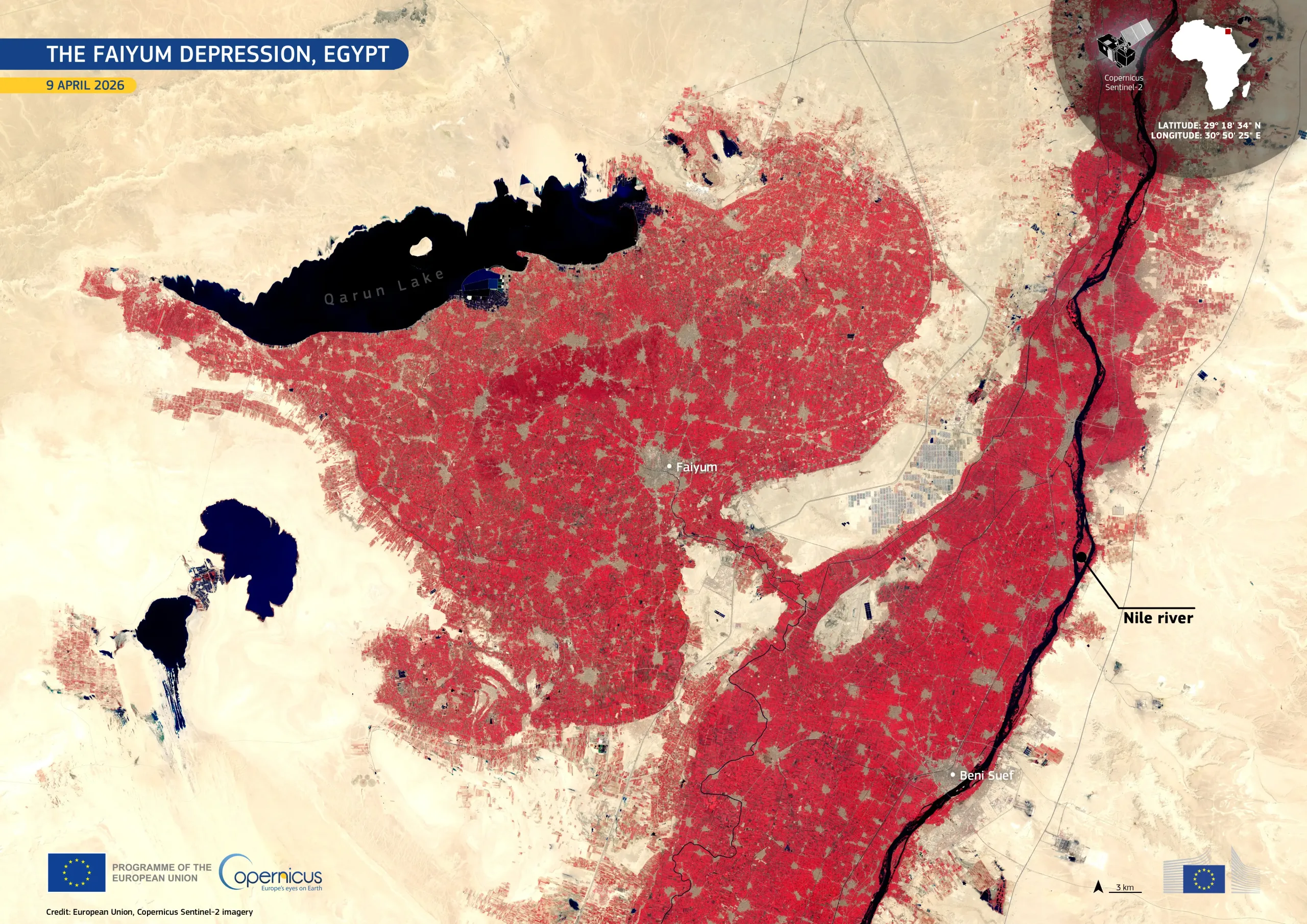
Located southwest of Cairo in northern Egypt, the Faiyum Depression is a long-established agricultural region sustained by water diverted from the Nile. The depression contrasts sharply with the surrounding desert and includes Lake Qarun, a saline remnant of a much larger ancient lake.
In this false-colour image acquired by one of the Copernicus Sentinel-2 satellites on 9 April 2026, vegetation appears in bright red, highlighting densely cultivated fields across the depression and along the Nile Valley to the east. Lake Qarun is visible as a dark expanse in the northwest, while the Nile appears as a narrow, dark ribbon. The boundary between irrigated land and arid desert is visible throughout the image.
Copernicus satellite data support monitoring of crop extent, irrigation patterns, and land use changes, informing sustainable water management in this water-scarce region.

![Download [WEBP, 1.9 MB]](https://eu-space.europa.eu/sites/default/files/2026-05/20260506_Faiyum.webp)