Strip Farming Landscapes of Gmina Sułoszowa, Poland
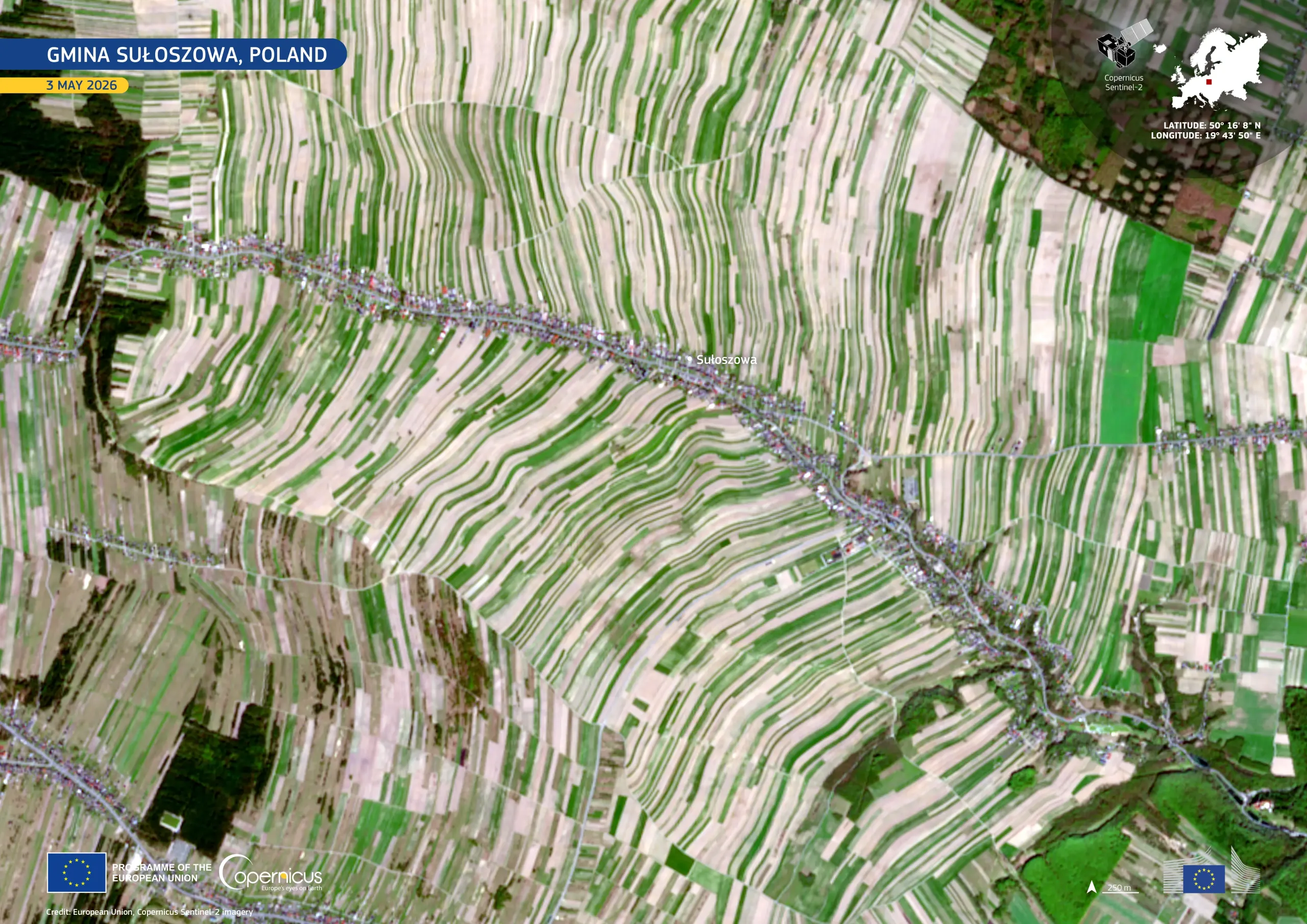
In southern Poland, the rural municipality of Gmina Sułoszowa is known for its remarkably elongated agricultural plots. The area is characterised by narrow strip fields extending from roads into the surrounding countryside, reflecting a historic farmland structure shaped by centuries of land division and cultivation practices, which remains visible today.
This image, acquired by one of the Copernicus Sentinel-2 satellites on 3 May 2026, shows alternating bands of bright green vegetation and pale beige or brown bare soils, creating a distinctive striped appearance across the rolling terrain. Sułoszowa, the village visible in the image, forms a dense linear settlement running diagonally through the centre of the scene, closely following the local road network.
Copernicus Sentinel-2 imagery supports the monitoring of agricultural land use, crop type and crop development, and landscape fragmentation, providing consistent data for rural planning and environmental management.
![Download [WEBP, 922.02 KB]](https://eu-space.europa.eu/sites/default/files/2026-05/20260510_Gmina%20Suloszowa.webp)