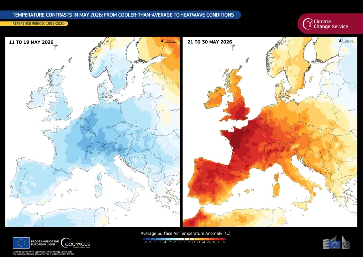
Image of the day
Wildfire on the Greek island of Crete
Earth Observation | Copernicus
Fires

Location: Greece
Credit: European Union, Copernicus Sentinel-2 imagery
On 6 April 2024, a wildfire broke out in a mountainous forest on the Greek island of Crete, leading authorities to order the evacuation of four villages affected by the fire. Though the blaze was fanned by strong winds, firefighters from Ierapetra and Agios Nikolaos were able to bring the fire under control with the help of water bomber aircraft.
The burn scar around the town of Mavros Kolimpos is visible in this image acquired by the Copernicus Sentinel-2 satellite on 6 April.
Copernicus Sentinel satellites provide open data that can help track and map areas affected by wildfires, allowing for better post-emergency response and damage assessments.


![Download [WEBP, 857.77 KB]](https://eu-space.europa.eu/sites/default/files/images/iotd/20240407_WildfireInCrete.webp)