Huelva wildfire among Spain’s worse of 2026
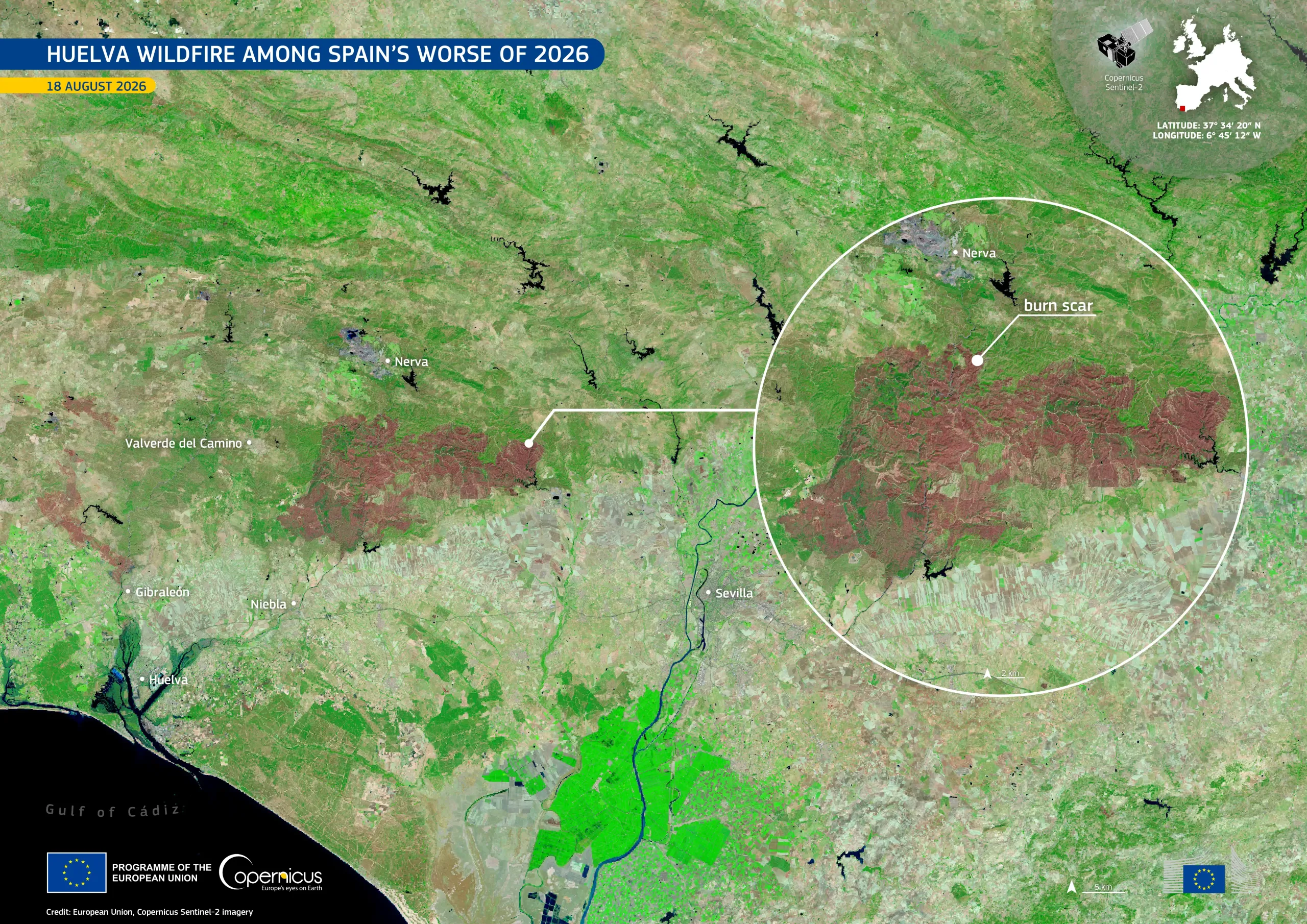
At the beginning of August 2026, a major wildfire broke out near Niebla, in the province of Huelva, southern Spain. After more than a week of firefighting operations, authorities declared the blaze stabilised on 16 August. The affected area exceeds 33,000 hectares, making it the second-largest wildfire recorded in Andalusia.
Acquired on 18 August 2026 by one of the Copernicus Sentinel-2 satellites, this false-colour image shows the extensive burn scar in shades of red and brown, while unaffected vegetation appears in bright green.
The Copernicus Emergency Management Service’s European Forest Fire Information System (EFFIS) reports that by 18 August close to 297,000 hectares had burned across Spain in 2026. More information is available here.