Image of the day
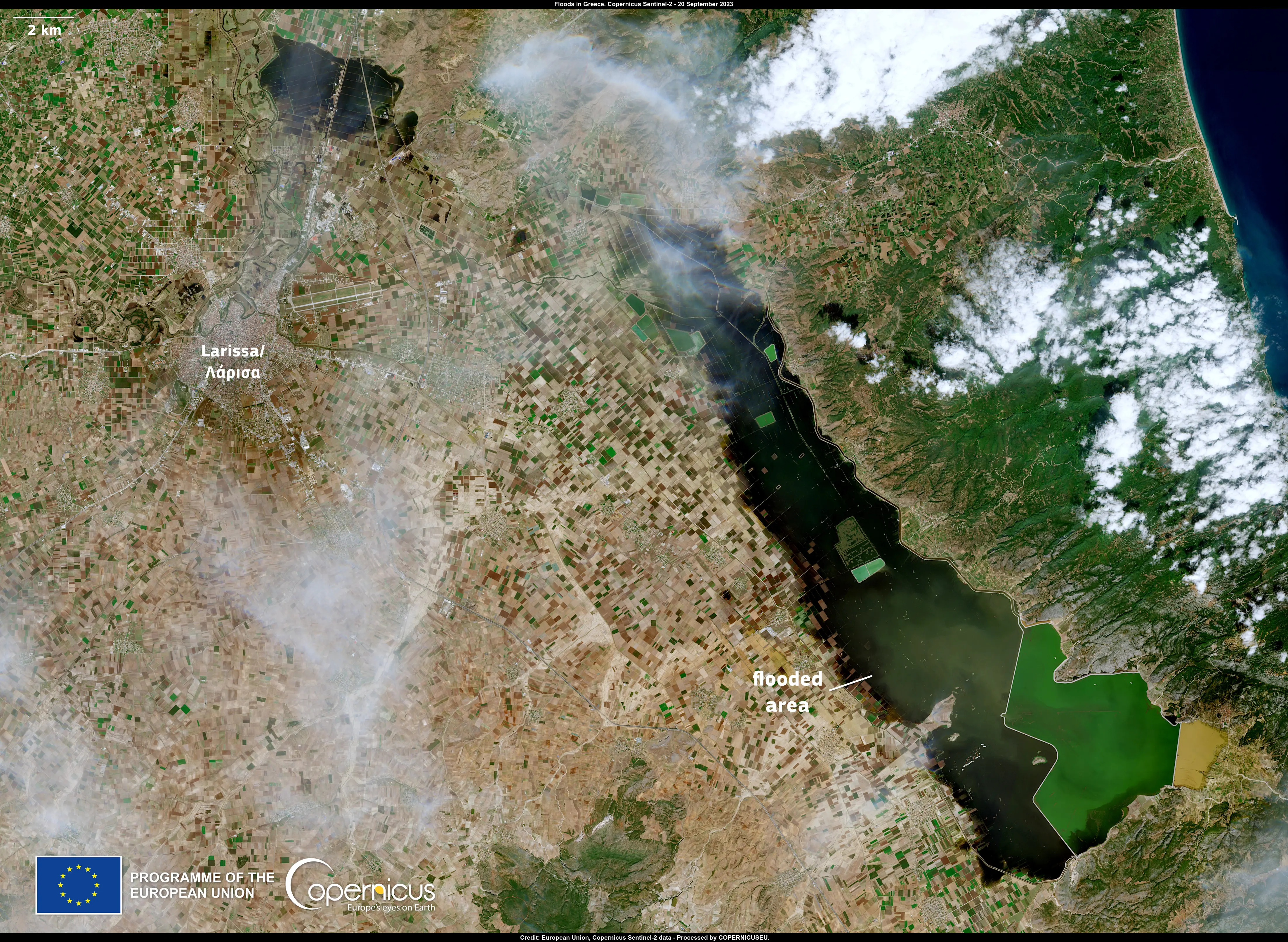
Agricultural areas around Thessaly, Greece, remain flooded
Earth Observation | Copernicus
Floods
Severe Storms

Location: Thessaly, Greece
Credit: European Union, Copernicus Sentinel-2 imagery
Storm Daniel and the consequent floods caused damage to over 700 km2 in Greece's central agricultural belt.
The dry soil has impeded the absorption of floodwaters, leaving some areas still submerged in several centimetres of water. This Copernicus Sentinel-2 satellite image, acquired on 20 September 2023, shows remaining agricultural areas submerged southeast of Larissa.
The Rapid Mapping Module of the Copernicus Emergency Management has been activated to monitor the floods in Greece (EMSR692). More details are available here.


