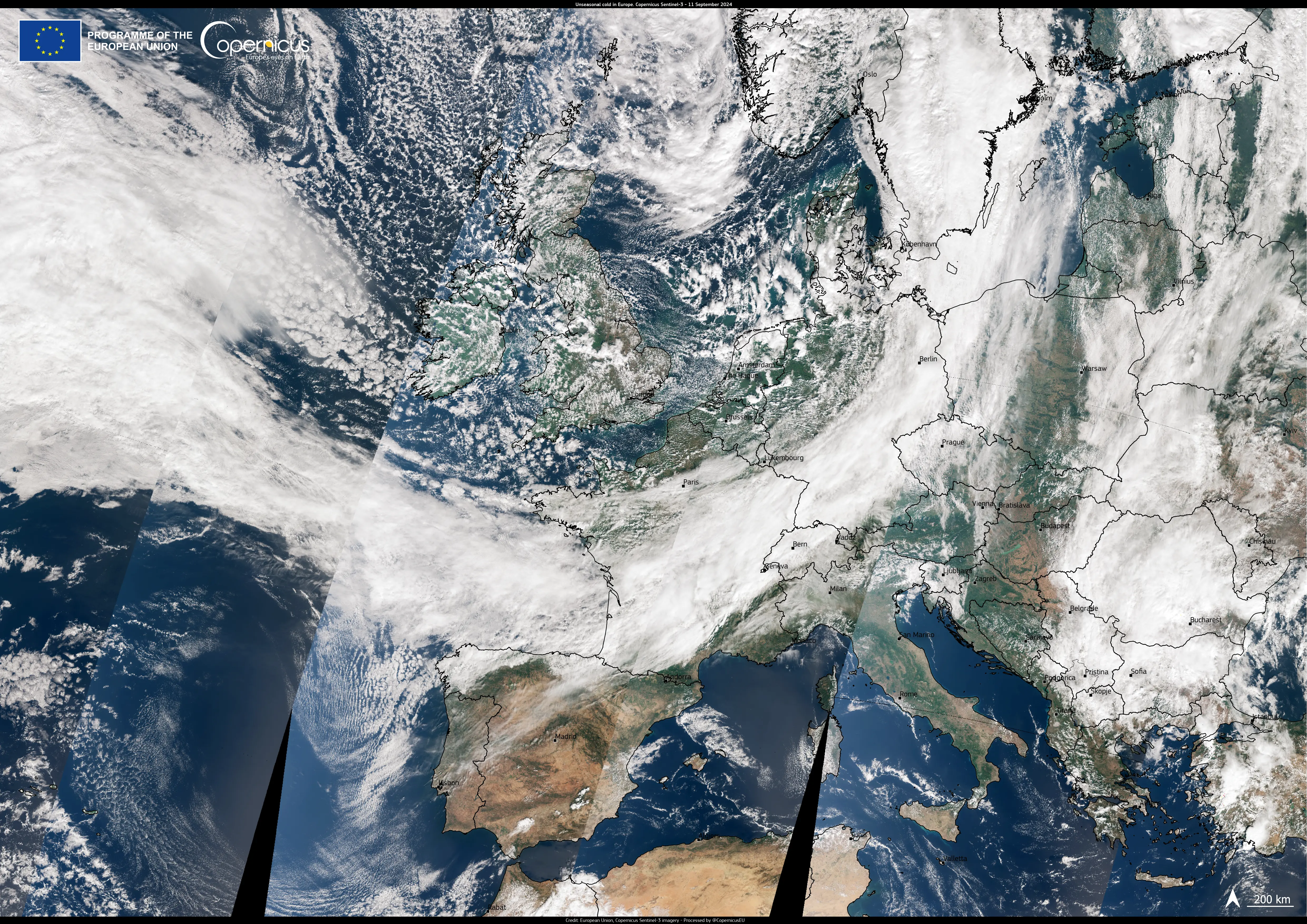
Arctic front brings unseasonal cold to Western Europe

This Copernicus Sentinel-3 image, acquired on 11 September 2024, shows a cold front approaching the coasts of France, Belgium and the Netherlands.
Driven by an unusual weather system over Scandinavia and accompanied by cold Arctic air, the front is moving south across Europe, bringing strong winds, a sharp drop in temperatures and early snow in the Alps at altitudes as low as 1,800 metres.
Weather experts are predicting "unseasonably cold" conditions, with parts of France and Italy potentially seeing record low temperatures for September. As the front progresses, heavy rain is likely to fall across central Europe, with Austria, the Czech Republic and Poland expected to receive more than 350 mm of rain in the next few hours.
The Copernicus satellites provide a vast amount of data which enable the monitoring of extreme weather events, such as cyclones, storms, as well as their consequences.


