Coastal sediments and erosion on the Yukon coast, Canada

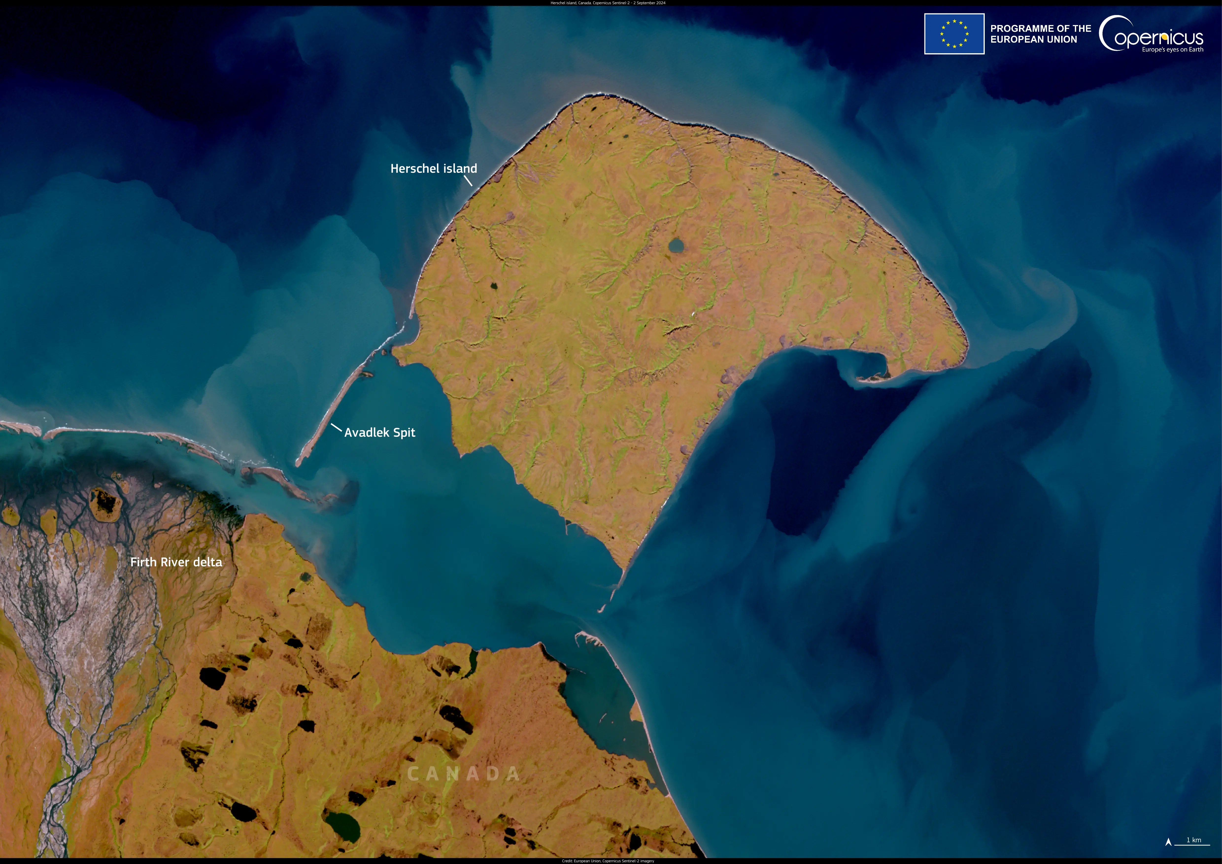
This image, acquired by one of Copernicus Sentinel-2 satellites on 2 September 2024, shows the Arctic coastline of Canada’s Yukon territory, where land meets the dynamic waters of the Beaufort Sea. In the image, Herschel Island (Qikiqtaruk), Avadlek Spit, and the Firth River delta are visible, all of which are affected by coastal and riverine processes.
Swirling patterns in the sea reveal suspended sediments, carried by currents and tides. These originate from river outflows, seabed disturbance, and coastal erosion—an increasingly pressing issue in the Arctic. In July 2024, Canadian scientists observed the Beaufort Sea encroaching on sections of Herschel Island, prompting the relocation of historic whaling buildings further inland before to prevent them from being lost to the ocean.
Satellite data from Copernicus Sentinel-2 is essential for monitoring sediment dynamics, coastal retreat, and the impacts of climate change in the Arctic, providing crucial information for conservation and long-term adaptation strategies.


