Copernicus Sentinel-6: measuring sea levels from space

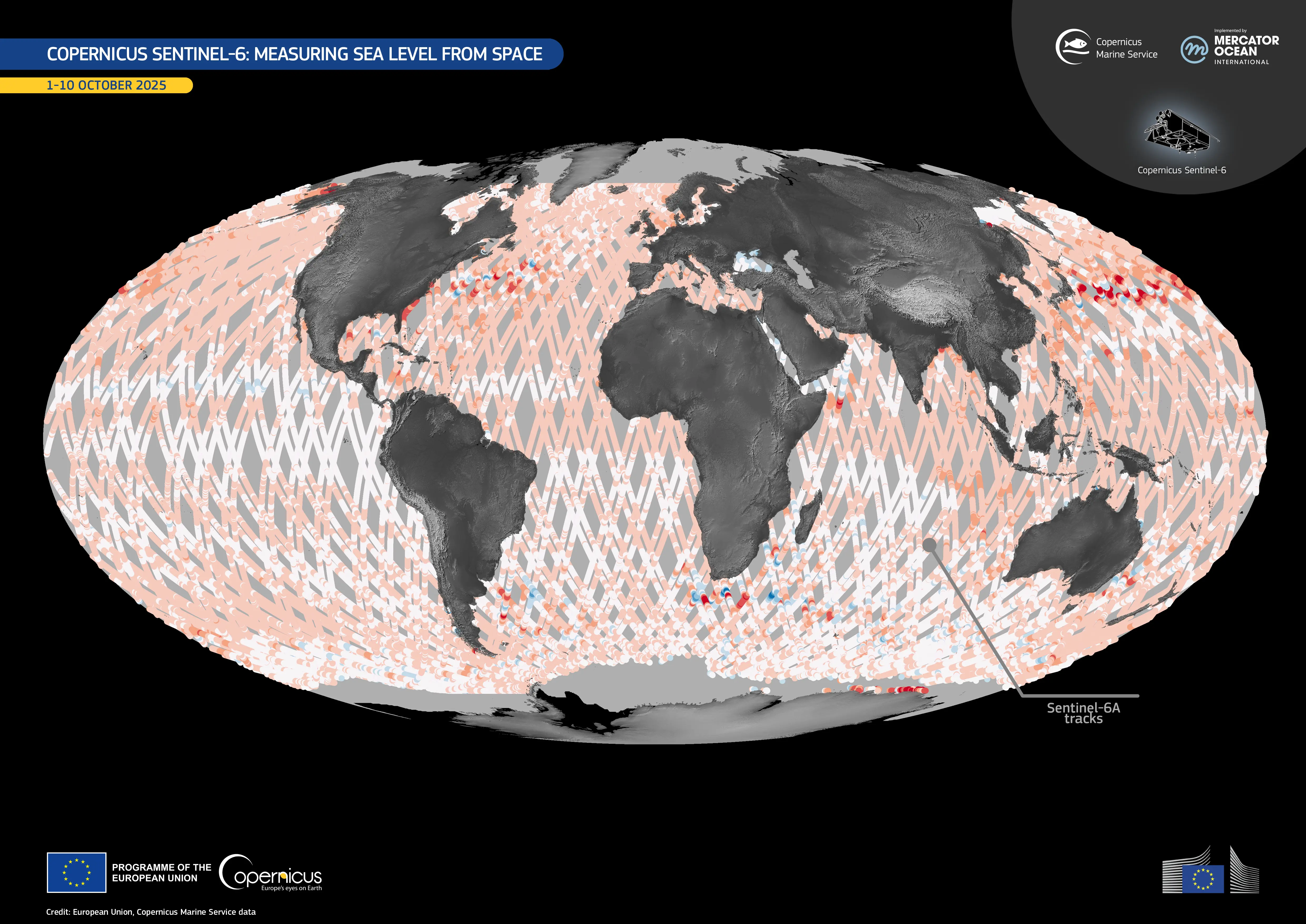
The Copernicus Sentinel-6 satellite mission is the global reference for measuring sea surface height. The first satellite of the mission, Copernicus Sentinel-6 Michael Freilich (Sentinel-6A), was launched in 2020. It follows a well-established, 10-day repeat orbit, delivering sea-level measurements with centimetre-level accuracy.
Data from Sentinel-6 are integrated with observations from other Copernicus Sentinel satellites and partner missions via the Copernicus Marine Service. Together, these sources provide operational ocean information and long-term climate records which help public authorities, industry, and researchers worldwide to sustainably manage ocean resources and understand our changing climate.
This visualisation, retrieved from the Copernicus Marine Service, shows sea surface height observations acquired by Copernicus Sentinel-6A along its ground track between 1 and 10 October 2025.
Copernicus Sentinel-6B, scheduled for launch in November 2025, will ensure the continuation of these measurements, maintaining the accuracy and stability of these global sea level records. With a nominal lifetime of around five and a half years, it will provide users across the world with reliable data through 2030.
You can find more information here.


