Devastating landslides and flooding in Chapula, Mexico

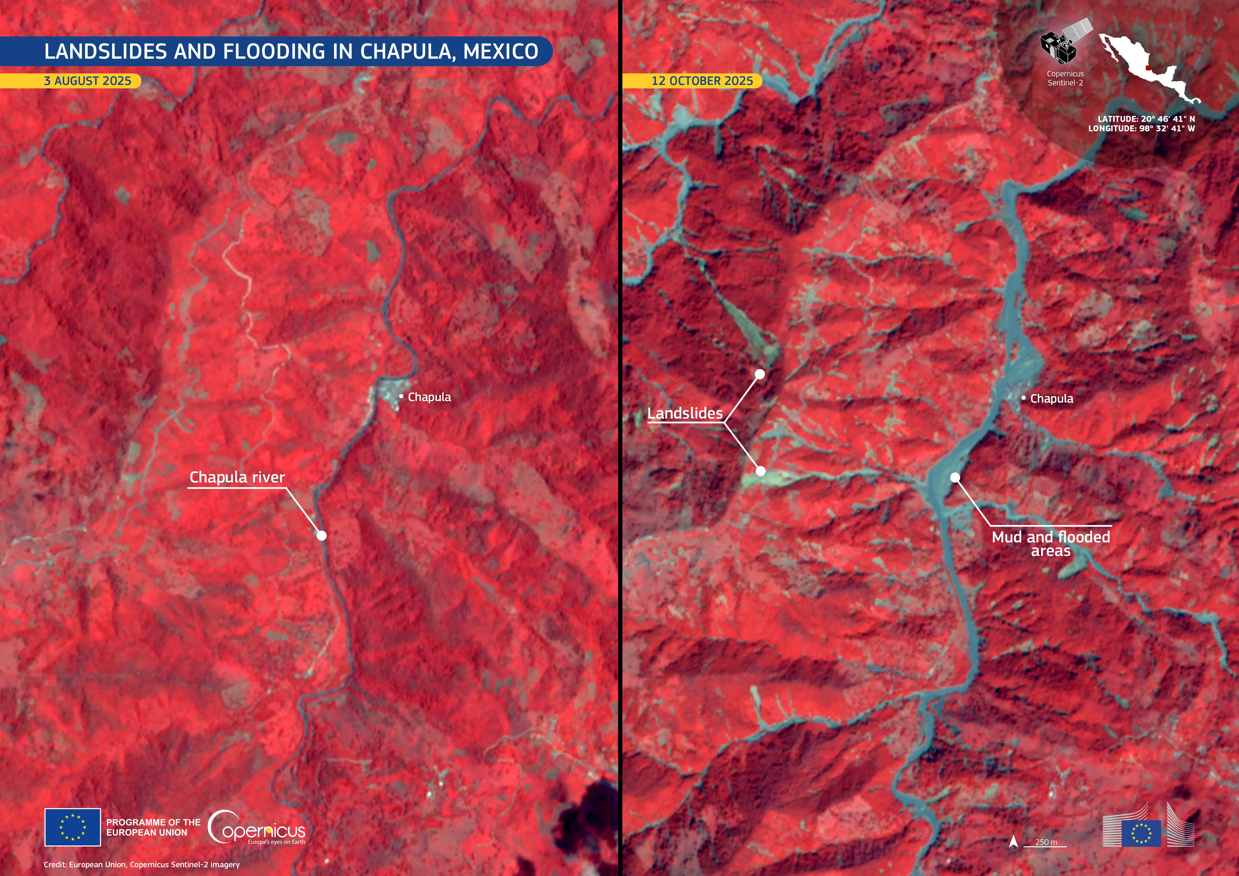
In October 2025, large parts of central and eastern Mexico have faced severe flooding, triggered by torrential rainfall from converging tropical storms. According to local authorities, there have been at least 64 reported casualties, with dozens of people missing. The village of Chapula has been particularly impacted by landslides and flooding from the overflowing Chapula River.
These false-colour Copernicus Sentinel-2 images clearly illustrate flooding along the Chapula River. In the image on the right, acquired on 12 October 2025, extensive blue tones, representing flooded areas, are visible along the river compared to the image on the left, acquired on 3 August 2025. In the more recent image, floodwaters can be seen covering vegetation, which appears in red. Several large landslides are also visible in the October image.
Open data from the Copernicus Sentinel satellites provides reliable monitoring of global flooding events. This information benefits local communities by informing response and recovery operations during disasters.


