Mapping settlement patterns across Cologne, Germany
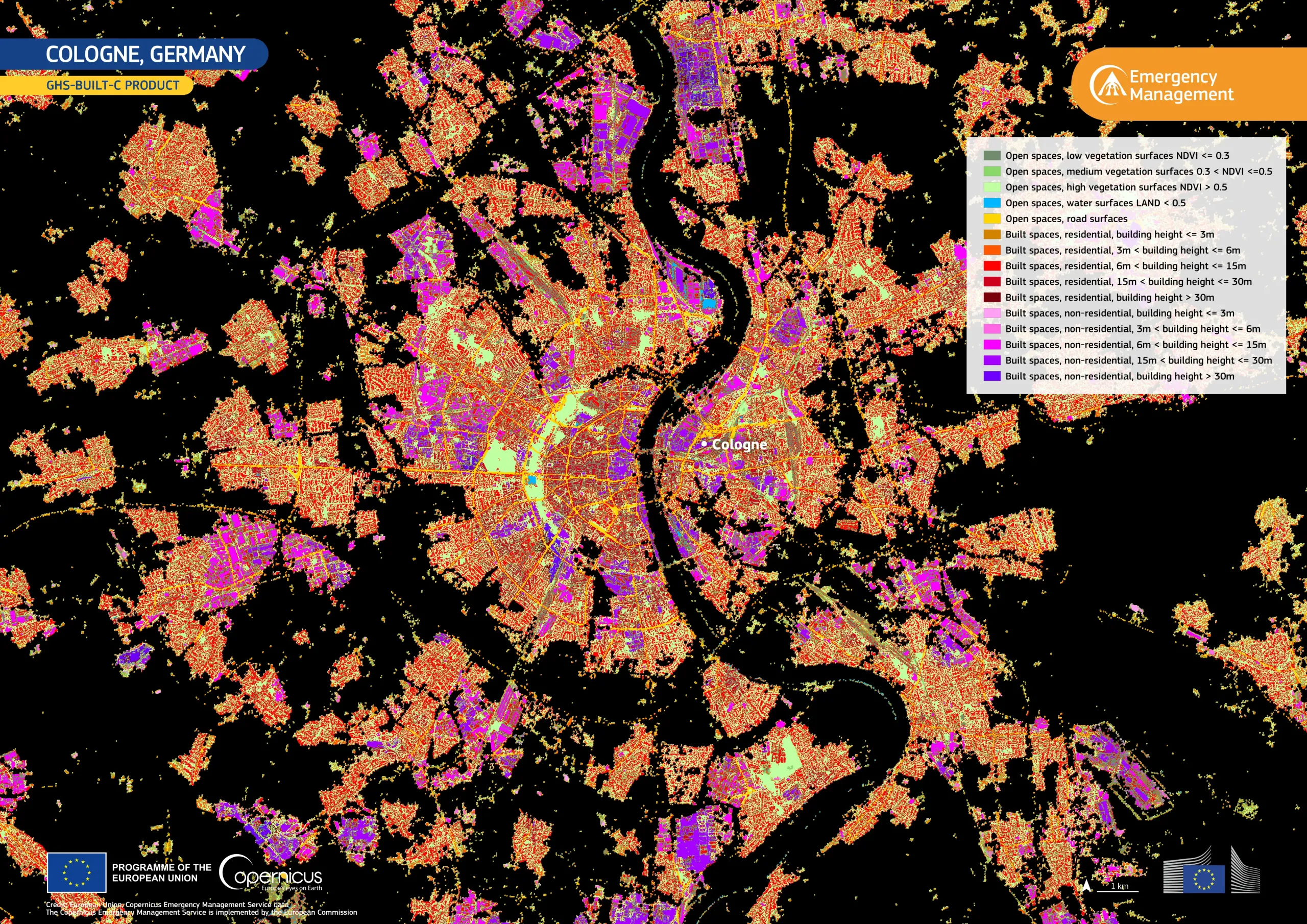
Cologne, located along the Rhine River, is one of the most important urban and economic centres in Germany, characterised by a dense historic city centre and extensive suburban expansion.
This visualisation, based on the GHS-BUILT-C (2018) product delivered by the Copernicus Emergency Management Service (CEMS), shows the spatial distribution of built-up areas across Cologne at 10 m resolution. Shades of red, orange, and purple represent classes of building height across built-up areas, while green tones represent high and medium vegetation cover around buildings and roads.
CEMS supports detailed urban monitoring, enabling authorities to assess urban exposure, plan sustainable development, and improve preparedness for environmental risks.

![Download [WEBP, 3.33 MB]](https://eu-space.europa.eu/sites/default/files/2026-05/20260505_GHSL%20Cologne.webp)