Sea ice drifts along Greenland’s east coast
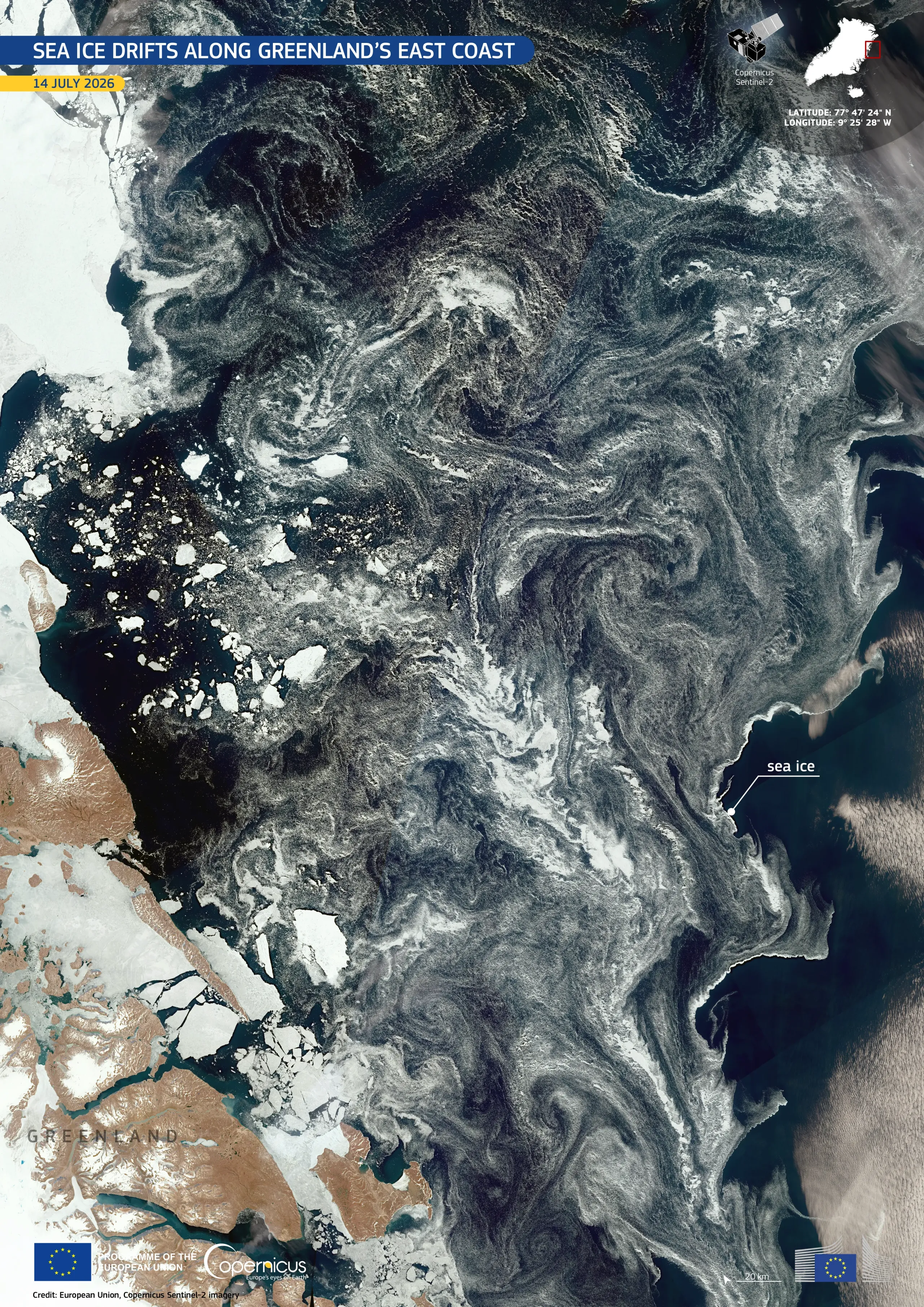
The waters along Greenland's east coast are shaped by strong ocean currents which transport Arctic sea ice southwards from the Greenland Sea and into the Denmark Strait. This continuous movement redistributes freshwater, influences marine ecosystems, and helps regulate regional ocean circulation and climate. As the ice drifts, ocean eddies and winds fracture the pack ice into intricate swirls, long trailing streaks, and scattered fragments. The result is a mosaic of sea ice and open water which provides seasonal habitat for Arctic wildlife and affects maritime navigation.
This image, acquired by one of the Copernicus Sentinel-2 satellites on 14 July 2026, shows the pattern created by the interaction between sea ice, ocean currents, and surface winds. Sea ice appears in bright white, while open water appears in dark blue to black. Fine grey streaks highlight thinner ice and surface features tracing the southward flow along Greenland's eastern coastline.
Copernicus Sentinel-2 data support the monitoring of sea-ice distribution and coastal conditions, contributing to climate research, maritime safety, and the assessment of seasonal changes in the Arctic.