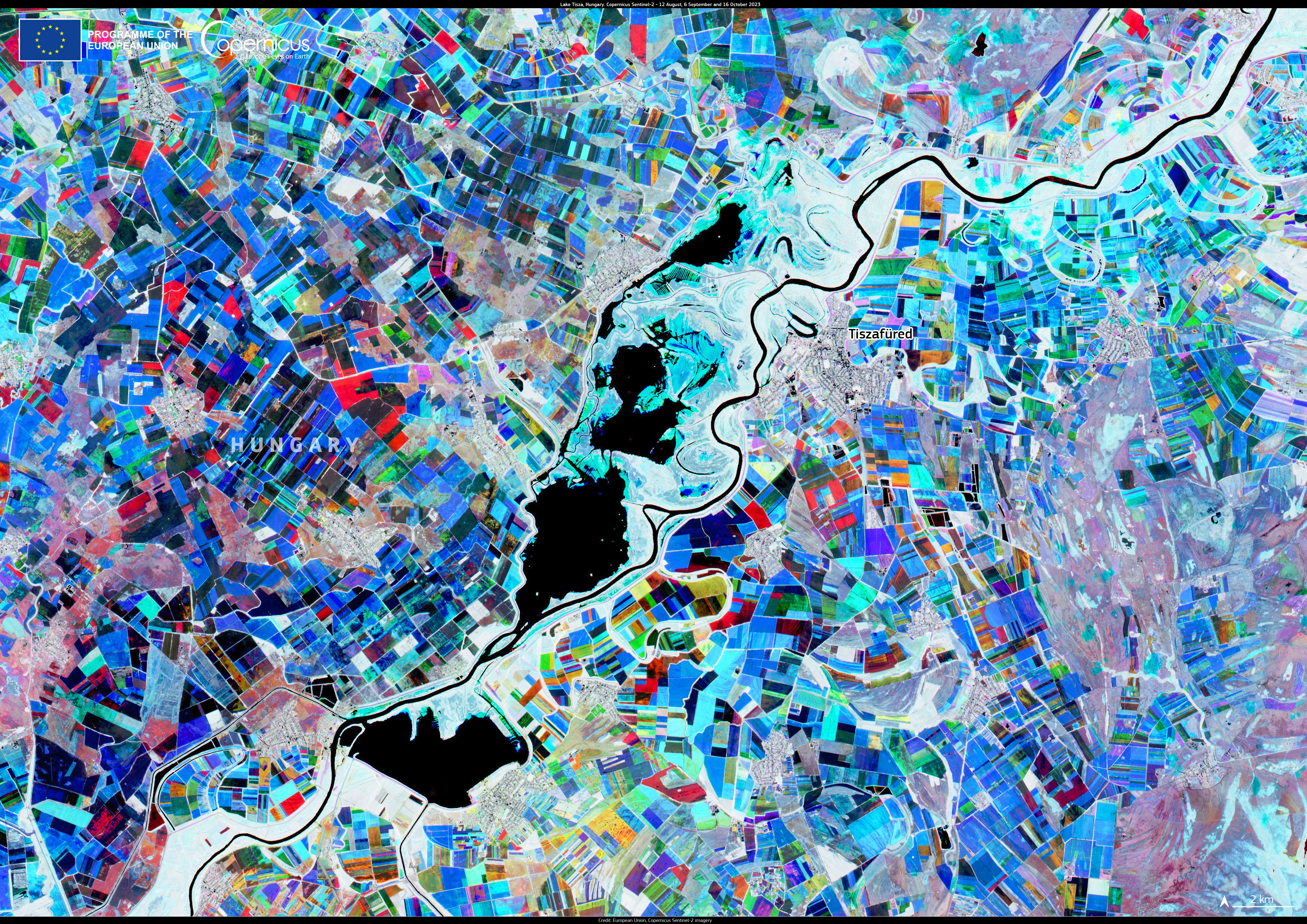
Lake Tisza, Hungary

Lake Tisza, located in eastern Hungary, is the country’s second-largest lake. Spanning approximately 127 square kilometres, it is known for its diverse ecosystems and popularity for activities such as fishing, boating, and birdwatching. The surrounding wetlands serve as a habitat for numerous bird species, making it a key area for conservation efforts.
This Copernicus Sentinel-2 image combines acquisitions from 12 August, 6 September, and 16 October 2023. Lake Tisza is visible in black, while the permanent vegetation around the lake is visible in white. The surrounding agricultural plots are shown in different colours depending on the period in which they were cultivated. In this image, the areas active in October are visible in red, the areas active in September are in green, and those in August are in blue. Yellow and orange plots show the areas active between September and October.
Satellite data from Copernicus plays a vital role in monitoring global water bodies, supporting communities in developing sustainable strategies which balance environmental preservation with recreational use.

