Fires in the Province of Chubut, Argentina
Large wildfires have been ongoing in Argentine Patagonia since early January 2026, impacting vast areas of native forest and shrubland. According to the local authorities, the fires spread across the provinces of Chubut, Santa Cruz and Neuquén, burning over 15,000 hectares of land and prompting the evacuation of over 3,000 residents and tourists from affected areas.
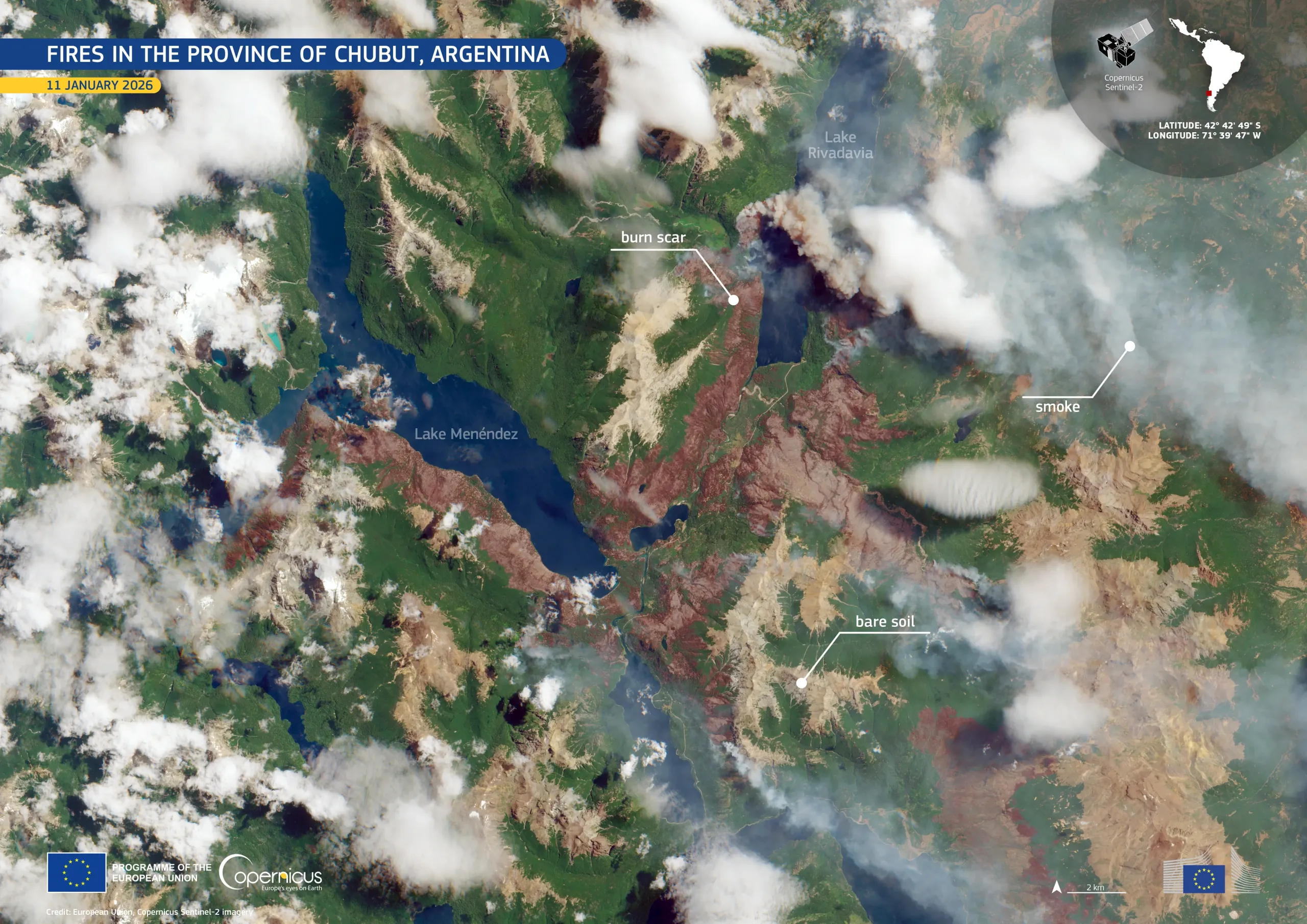
This image, acquired on 11 January 2026 by one of the Copernicus Sentinel-2 satellites, focuses on an active fire in the province of Chubut. Healthy vegetation appears in green, while burned areas are visible as dark brown and reddish patches. Bare soil is shown in cream tones and smoke plumes are visible drifting eastwards.
Copernicus Sentinel-2 data supports wildfire monitoring by mapping burn scars, tracking fire spread, and providing timely information to support emergency response and post-fire environmental assessment.


![Download [WEBP, 1.16 MB]](https://eu-space.europa.eu/sites/default/files/2026-01/20260118_Fires%20Argentina.webp)