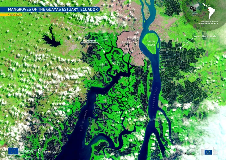
Flooding in Ecuador

Since January 2025, heavy rainfall has affected 23 out of 24 provinces in Ecuador, leading to flooding, landslides, and destruction of infrastructure. With nearly 20,000 people impacted, the country’s government has declared a state of emergency in eight coastal provinces.
On 26 February 2025, the Copernicus Emergency Management Service (CEMS) has been activated to provide landslide and flood extent and damage assessment mapping (EMSR789). This data visualisation based on CEMS data shows the evolution of flooded areas between 24 February and 2 March in blue tones.
Copernicus delivers open data which is essential for monitoring floods and their impacts around the world. This information provides valuable insights during and after flooding events, helping inform rescue and recovery operations.
![Download [WEBP, 1.33 MB]](https://eu-space.europa.eu/sites/default/files/images/iotd/20250304_EMSR789_Floods_20Ecuador.webp)