Tidal dynamics at Passage Du Gois, France
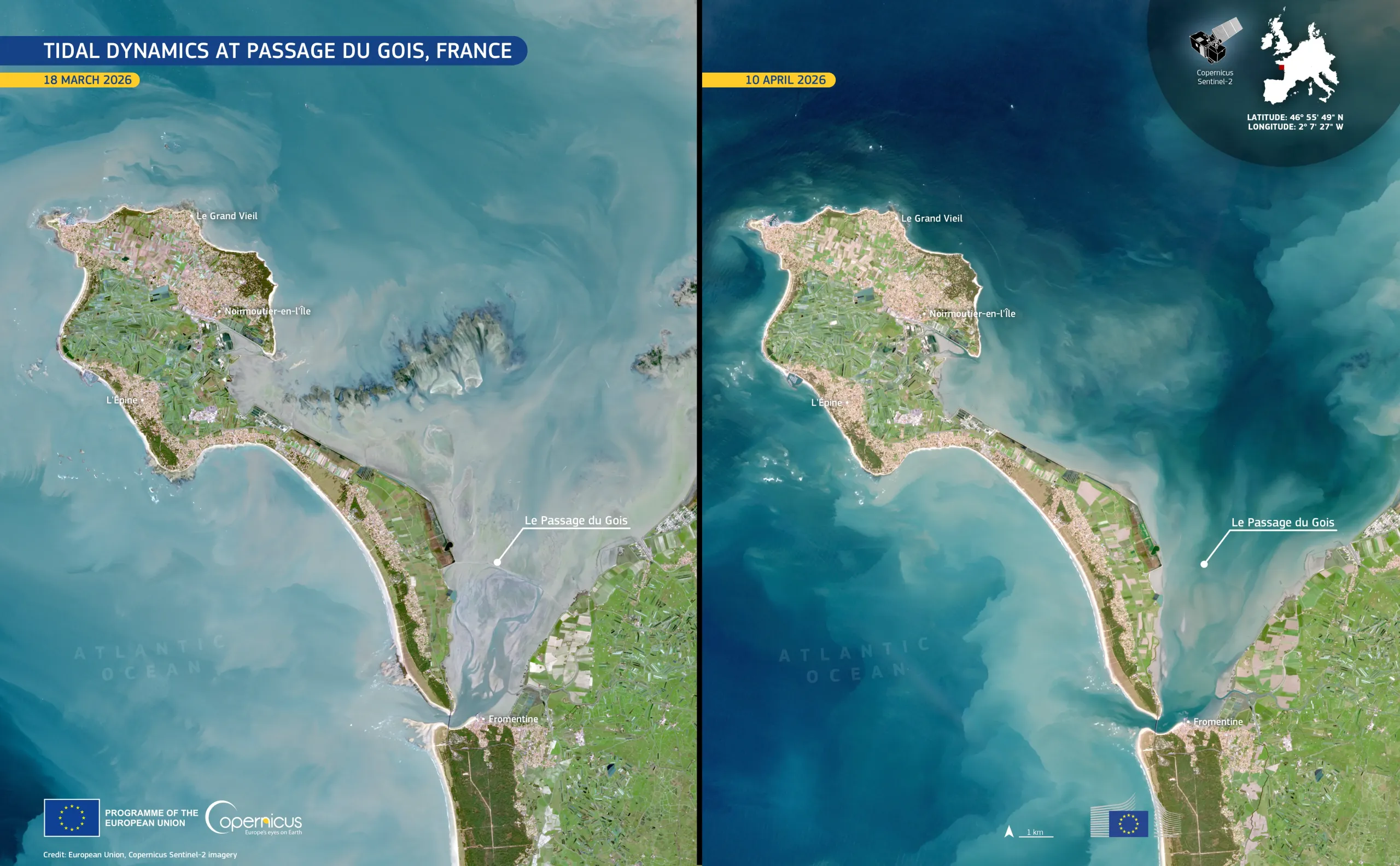
The Passage du Gois, which links the island of Noirmoutier to the mainland in western France, is an intertidal causeway regularly submerged at high tide, restricting access to and from the island. This coastal setting, located in the Vendée department, is characterised by extensive intertidal flats and shallow bays shaped by strong tidal currents and sediment transport, which together define a distinctive landscape and often present challenges for local access and safety.
Two Copernicus Sentinel-2 images illustrate this tidal variation. In the image acquired on 10 April 2026 (right), the causeway is largely concealed by the tide. The image acquired on 18 March 2026 (left) shows the causeway partially exposed along its length, in shades of grey and green characteristic of low tide conditions. The mosaic of surrounding farmland provides a visual contrast to the shifting tidal zone along the coast.
Copernicus Sentinel-2 data support the regular monitoring of tidal environments by tracking sediment movement, assessing evolutions in coastal morphology, and informing local authorities responsible for access management and risk mitigation in intertidal zones.
![Download [WEBP, 850.15 KB]](https://eu-space.europa.eu/sites/default/files/2026-05/20260508_Le%20Passage%20du%20Gois.webp)