Copernicus, the Earth Observation component of the EU Space Programme, delivers key data which supports better decision-making across Europe and beyond. From informing environmental and public health policies, improving safety and security, and generating socio-economic benefits, the insights provided by Copernicus benefit EU citizens and people around the world.
Using data from advanced satellite technology, validated and improved by ground-based sensors and monitoring stations, Copernicus continuously observes our planet’s land, oceans, and atmosphere. These assets in space and on the groundwork together to gather and validate high-quality data, which is then processed and analysed.
This information plays a key role in managing cites, agricultural land, coastal regions, and the global ocean, protecting the environment, and strengthening our response to global challenges such as climate change and disasters.
The European Union is the owner of the Copernicus Sentinel satellites, which are developed by the European Space Agency (ESA) with the European space industry. The data they collect supports a wide range of applications including agriculture, atmosphere monitoring, forest and land use mapping and urban planning.
In addition to the Copernicus Sentinel satellites, Copernicus also benefits from ‘contributing missions’. Contributing missions are existing commercial and government satellites providing part of their data to help feed and improve Copernicus products and services.
Sentinel satellites are organised into 6 missions with several similar satellites per mission. Each mission has its unique focus and dedicated sensor types:
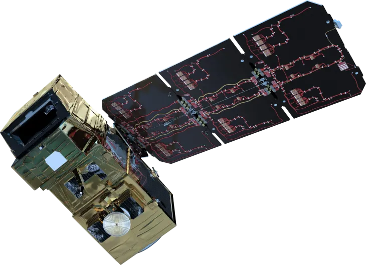
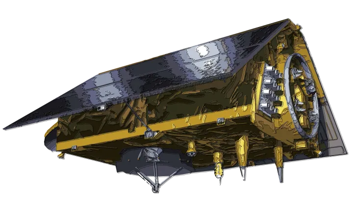
Copernicus Sentinel-1
The Sentinel-1 mission provides high-resolution all-weather, day and night radar imagery of the Earth’s surface.
Sentinel-1 satellites radar sensors are particularly useful for crop monitoring, measuring ground movement after earthquakes, and measuring water cover, including during floods.
Copernicus Sentinel-2
The Sentinel-2 mission provides high-resolution optical imagery over land and coastal areas, supporting applications such as vegetation monitoring, land and water cover mapping, and disaster management.
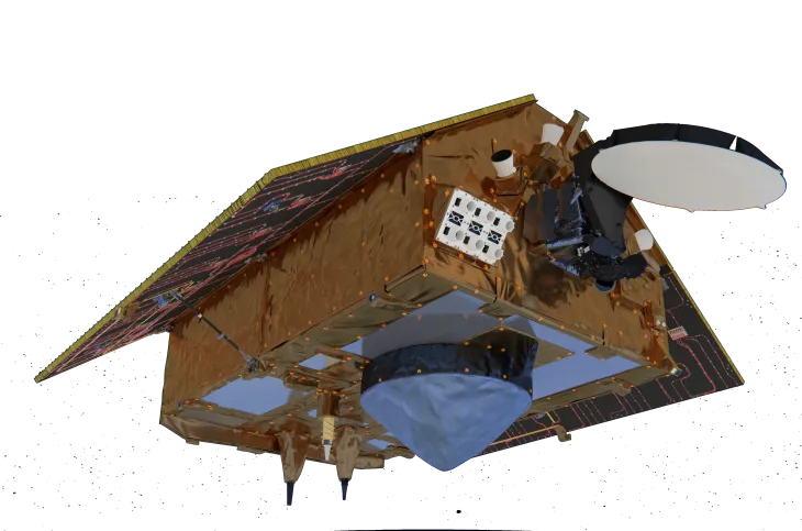
Copernicus Sentinel-3
The Sentinel-3 mission monitors Earth’s oceans, land, and ice to track large scale environmental change. It carries optical, thermal, microwave, and altimetry instruments to measure sea surface temperature, ocean colour, and surface topography. This data is critical to understand how climate change is affecting the Earth’s environments.
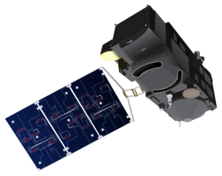
Copernicus Sentinel-4
The Sentinel-4 mission monitors key air quality trace gases and aerosols over Europe, providing hourly data on key gases such as nitrogen dioxide, ozone, sulphur dioxide, formaldehyde, and aerosols. This data is key for air quality measurements, weather forecasts, and understanding our atmosphere.
Copernicus Sentinel-5
Sentinel-5 is dedicated to atmospheric composition monitoring. Sentinel-5 satellites provide accurate measurements of key atmospheric constituents such as ozone, nitrogen dioxide, sulphur dioxide, carbon monoxide, methane, formaldehyde, and aerosol properties. Sentinels-4 and -5 are complementary, with one providing hourly data over Europe, and the other providing data covering the entire globe.
Copernicus Sentinel-6
Sentinel-6 provides high accuracy altimetry for measuring global sea surface height, primarily for operational oceanography – enabling precise ocean circulation models and long-term sea level trend analysis – and for climate studies.
Copernicus is the European Union’s Earth observation programme. It uses satellite data, measurements from ground stations, and modelling tools to provide timely, reliable information about our planet. The programme supports public authorities, businesses, researchers, and citizens with free and open data. Copernicus is organised into six thematic Services:
All Copernicus data and services are free, open, and accessible, enabling better decision-making, innovation, and a stronger understanding of our changing planet.
For its operations, Copernicus does not only feed from satellite-based information, but it also depends on data collected on our planet — from the ground, the air, and the sea. This data constitutes the Copernicus In-Situ Component, so called because it is collected within the Earth’s environment rather than from space.
In-situ data measure things such as wind speed, air quality parameters, sea temperature, currents, snow cover and much more, all to make sure Copernicus data and services are accurate, trustworthy, and complete.
In-situ data is everywhere across the Copernicus programme. It plays a crucial role in the generation and enrichment of satellite data, products and services of Copernicus, and in improving their accuracy, consistency and reliability.
The European Environment Agency (EEA) leads the overall, cross-cutting coordination of Copernicus In Situ, while the Copernicus Entrusted Entities, which manage the other Copernicus components and deliver the services and products, ensure their own operational access to in-situ data.
The EEA maps in-situ requirements and existing data gaps, engaging with in-situ data providers to address them.
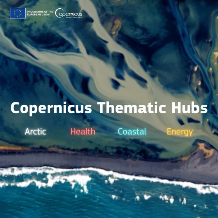
The Thematic Hubs are web portals under the EU Copernicus programme designed to provide easy, thematic or region-specific access to Earth Observation data. They aggregate data, tools, and use cases relevant to certain geographic zones (like coastal areas or the Arctic) or thematics (e.g. health, energy), acting as a single entry point to data from multiple Copernicus services. They draw from all relevant Copernicus services. The Thematic hubs are intended to:
- simplify access to data for users concerned with specific environments;
- support policy implementation by giving tailored, relevant data;
- foster innovation, help create downstream services and applications;
- encourage uptake by making tools, use cases, visualisation, etc. more accessible;
The Copernicus Thematic Hubs bring together data and products provided by different Copernicus services to simplify and streamline user access to relevant data, acting as a single entry point. The four thematic hubs focus on:
The benefits of space-based imagery and radar data appear in many aspects of our daily lives: getting alerts on air quality and improving weather forecasting; for climate researchers to better understand and mitigate the consequences of climate change; and for emergency services to be better prepared when a disaster strikes with up-to-date maps of the affected areas. Businesses also increasingly rely on satellite data to develop new apps, products and services.
The EU’s Copernicus Data Policy ensures that all Copernicus data, products, and services are provided for free. And – aside from sensitive, security-related contexts – the data is openly accessible. Anyone can use Copernicus data for any reason: to conduct research, to develop an app, to start a business…the sky’s the limit!
application areas.
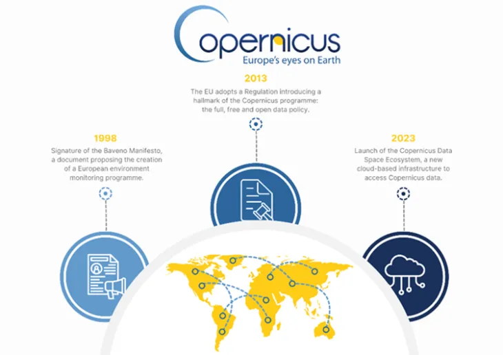
A Timeline of Copernicus