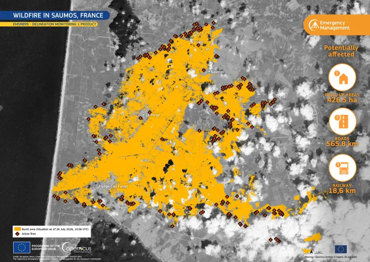
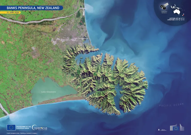
Severe flooding in New Zealand

In late April 2025, a rapidly deepening area of low pressure in the Tasman Sea triggered flooding and severe weather across New Zealand, prompting a red warning from the national MetService and a state of emergency to be issued in Christchurch. In some regions, more than 100 mm of rain fell in under 12 hours, leading to burst riverbanks and road closures. Strong winds exceeding 144 km/h were recorded in the capital, Wellington.
Sediments poured into the Pegasus Bay near Christchurch as a result of the storm are clearly visible in this image acquired by one of the Copernicus Sentinel-3 satellites on 4 May 2025.
The Copernicus Sentinel satellites provide valuable data to identify and delineate the extent of areas affected by floods and to monitor the consequences of such events.
![Download [WEBP, 1 MB]](https://eu-space.europa.eu/sites/default/files/images/iotd/20250506_Floods_20New_20Zealand.webp)